

Larvik, Stavern and Sandefjord by boat: routes and harbours
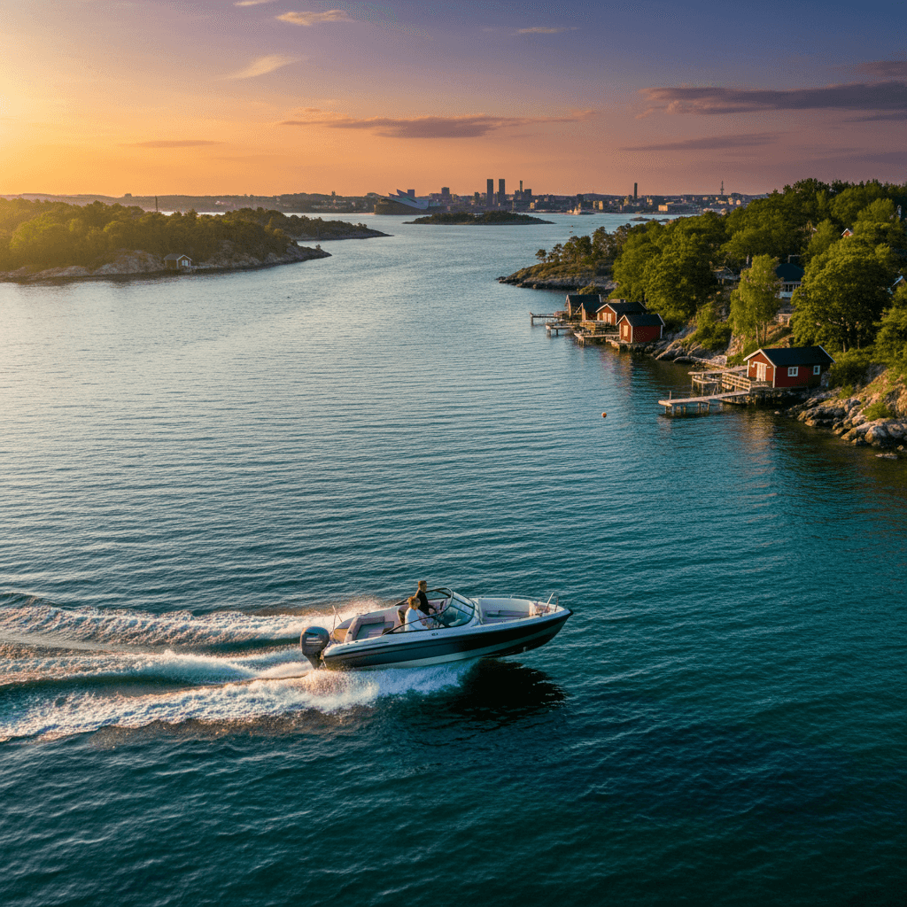
Southern Vestfold packs a lot of coast into a short stretch of the outer Oslofjord. Along a short stretch of coast you have the summer town of Stavern with the old Fredriksvern naval base, the Svenner lighthouse islands out in the Skagerrak, the harbour villages of Nevlunghavn and Helgeroa, Mølen, which is Norway's largest pebble beach, and the sheltered fjords and public islands around Sandefjord. You can do short family trips in calm water or longer days out towards the open sea.
Where can you rent a boat in Larvik, Stavern and Sandefjord?
Private owners rent out motorboats, RIBs, daycruisers and sailboats along this whole coast. Browse boats for rent in Larvik, boats for rent in Stavern, boats for rent in Sandefjord and rent a boat in Helgeroa. Each owner states in the listing what licence and experience they require, and some owners can come along as skipper if you would rather not drive yourself.
5 boat trips in Larvik, Stavern and Sandefjord
The distances below are rough estimates in nautical miles (nm) measured on the map. Always plan and navigate with a chart or a chart app. In Norway a gjestehavn is a guest harbour, where visiting boats can stay overnight for a fee.
Stavern to Svenner lighthouse
Svenner is a group of islands with a lighthouse station south-east of Stavern. It is approx. 4 nm from Stavern to the lighthouse, roughly 15 to 25 minutes each way in a planing boat. Visit Vestfold describes Svenner as the archipelago at its best: sun-warmed rocks, clear water, swimming, fishing and paths around the lighthouse. You can moor in three harbours, Nordbogen, Røvika and Fyrhavna, either along the rock or at the pier, and there is good holding for an anchor in the sandy bottom. The birdlife on Svenner has been protected since 1935, and many seabirds nest here from April to June.
Tip: Entering and leaving the harbours is not recommended in strong wind. Check the forecast first, as Svenner is exposed to the Skagerrak.
Stavern, Nevlunghavn and Helgeroa, with Mølen on foot
This route follows the outer coast of Brunlanes westwards. From Stavern it is approx. 6 nm to Nevlunghavn, then approx. 3 nm more around Mølen to Helgeroa. Allow half a day to a full day. On the way you pass Tvistein lighthouse, which sits on the edge of the open sea off Nevlunghavn. Nevlunghavn guest harbour has 35 guest berths and Helgeroa guest harbour has 60, both with showers, toilets, fuel, electricity and a kiosk.
Mølen is Norway's largest pebble beach and part of the Ra moraine left by the last ice age. It has about 230 burial cairns from the Bronze and Iron Ages, more than 100 rock types and over 300 recorded bird species. Visit Vestfold recommends reaching Mølen on the coastal path from Nevlunghavn or Helgeroa.
Tip: Leave the boat in the guest harbour and walk the coastal path to Mølen rather than trying to land on the exposed pebble beach.
The Larviksfjord: Larvik to Stavern
A calm trip for your first day on the water: approx. 4 nm from Larvik town down the fjord to Stavern, about 20 to 30 minutes with plenty of slow-speed margin. In Stavern you find Fredriksvern verft, Norway's first main naval station, founded in 1750, and Citadelløya, the island where the first fortress was built in 1677. The shipyard area is open to the public, with exhibitions and galleries. Stavern guest harbour is the largest in Larvik, with 200 guest berths right in the town centre.
Tip: Color Line sails twice a day between the Revet terminal in Larvik and Hirtshals in Denmark. Keep well clear of the ferry, and remember the 8-knot limit in Larvik harbour basin and 5 knots in Stavern harbour.
Sandefjordsfjorden and the public islands
Start at Sandefjord guest harbour, in the middle of the harbour next to the whale catcher museum ship Southern Actor. It has about 60 berths with 2.5 to 4 metres of depth and is well sheltered from wind in all directions. Head out the fjord to the public recreation area on Furuholmen in Granholmsundet, which has a mooring pier, an outdoor toilet and a fire pit. Further out lie Asnes on Vesterøya, with a sandy beach and a pier, and the islets Hellesøya and Buerøya, both with toilets. From the town centre to Hellesøya is approx. 3 nm. Allow 2 to 4 hours with swimming stops.
Tip: Between Asnes and Framnes the speed limit for leisure boats is 8 knots, and in the inner harbour it is 5 knots.
Around Østerøya: Tønsberg tønne and Stauper
For a longer day out, run down Sandefjordsfjorden and around the southern tip of Østerøya, where the Tønsberg tønne sea mark stands, approx. 6 nm from Sandefjord. Further up the Tønsbergfjord lies Stauper, about 20 islands, islets and skerries that can only be reached by boat. Stauper is a state-secured public recreation area with mooring bolts, an outdoor toilet and bins. The total is approx. 8 to 9 nm each way from Sandefjord, which makes it a full-day trip. On Østerøya itself, the Truber and Yxney area has a sandy beach and smooth rocks facing the Tønsbergfjord.
Tip: Check the wind forecast before rounding the southern tip of Østerøya, and carry a good fuel margin for the return.
| Route | Distance | Time | Highlight | Suits |
|---|---|---|---|---|
| Stavern – Svenner lighthouse | approx. 4 nm | half day | Lighthouse, rocks, swimming | Families in good weather |
| Stavern – Nevlunghavn – Helgeroa | approx. 9 nm | half to full day | Mølen, Tvistein lighthouse, harbours | Experienced, open water |
| Larvik – Stavern | approx. 4 nm | 1–2 hours | Fredriksvern, Citadelløya | Beginners |
| Sandefjordsfjorden and islands | approx. 3 nm | 2–4 hours | Furuholmen, Asnes, swimming | Families |
| Around Østerøya to Stauper | approx. 8–9 nm | full day | Tønsberg tønne, Stauper | Long day trip |
Rules and safety in Larvik, Stavern and Sandefjord
- Speed limits in Larvik: 5 knots within 100 metres of land, islets and skerries outside the main and secondary fairways, and 30 knots elsewhere. 8 knots in Larvik harbour basin and 5 knots in places such as Stavern harbour, Helgeroa, Kjerringvik and Viksfjord. See the Larvik regulation on Lovdata (in Norwegian).
- Speed limits in Sandefjord: 5 knots in the inner harbour and 8 knots for leisure boats between Asnes and Framnes, under the national regulation on speed limits at sea (in Norwegian).
- Seabird reserves: Many islets and skerries are protected. In reserves such as Bølene and Fugløyrogn in Larvik and Marøyskjæra in Sandefjord, all traffic on land and on the water inside the protected area is banned from 15 April to 15 July. Check the Norwegian Environment Agency's map of access bans before you go ashore.
- Ferries: Color Line sails Larvik to Hirtshals and Sandefjord to Strömstad, with two departures a day on each route. Keep well clear when they enter and leave the fjords.
- Open sea: Svenner, Tvistein and Mølen face the Skagerrak, and the sea there can be rough even when the fjords are calm.
- Fires: From 15 April to 15 September it is forbidden to light fires in or near forests and fields.
- Licence: Anyone born on or after 1 January 1980 needs a boat licence (båtførerbevis) to drive a boat over 8 metres or with an engine over 25 hp. Foreign visitors should read our guide to the Norwegian boat licence to see which licences are accepted.
Best time for a boat trip in Larvik, Stavern and Sandefjord
The main season runs from June to mid-August. That is when Stavern and the guest harbours are busiest, and scheduled boats and water taxis run from Stavern to Svenner. From late June to early August the scheduled boat Skjæløy II also links Langesund and Helgeroa through the islands. After 15 July the access bans in the seabird reserves end, and it becomes easier to find an islet to go ashore on. Spring and autumn are good for quiet trips and birdwatching at Mølen, which is an important stopover for migrating birds.
FAQ
Can you land at Mølen by boat?
Mølen is a pebble beach exposed to the Skagerrak. Visit Vestfold recommends reaching it on the coastal path from Nevlunghavn or Helgeroa, so the easiest option is to moor in one of those guest harbours and walk.
Can you stay overnight on Svenner?
Yes. The stone house on Svenner is let through Svenner Fyr Kystled and has 19 beds in 6 rooms. Camping is also allowed. Bring a sleeping bag, food and drinking water.
How many guest berths are there?
Stavern guest harbour has 200 berths, Helgeroa 60 and Nevlunghavn 35. Sandefjord guest harbour has about 60, and Sandefjord Miljømarina lies in the western part of the harbour.
Are there toilets on the Sandefjord islands?
Yes. Sandefjord municipality provides toilets on Furuholmen, Hellesøya and Buerøya in Sandefjordsfjorden, Gokstadholmen in Mefjorden, Stauper and Vakersholmen in the Tønsbergfjord, and Ravnø, Gåsø and Gåsøkalven in Vestfjorden. Bring your own paper.
What is Gea Norvegica Geopark?
Gea Norvegica is a UNESCO Global Geopark of about 3,000 km² in Vestfold and Telemark, and Larvik is one of its municipalities. The first geopark in the Nordic countries opened at Mølen in 2008. Larvikite, Norway's national rock, is the dominant rock type in Larvik.
To keep going east, read our guide to Færder and Tjøme by boat. Heading west towards Langesund, continue with Grenland by boat.



