

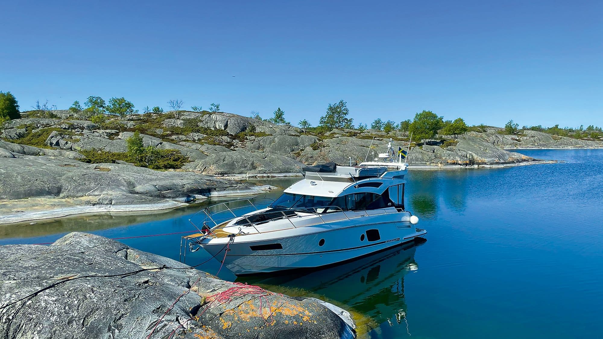
Hvaler by boat: Skjærhalden, Akerøya and Fredrikstad
Hvaler is the archipelago of islands, islets and smooth bare rocks at the far south-eastern corner of Norway, near the Swedish border, and much of it lies inside Ytre Hvaler National Park, described as Europe's first marine national park. By boat you can start in Fredrikstad, pass the fortified Old Town on the Glomma river and reach Skjærhalden in little more than an hour. From there you can reach the sandy beaches of Søndre Sandøy, Tisler on the edge of the open sea, and Akerøya with its fort and birdlife, which you can only reach by your own boat or kayak.
Where can you rent a boat in Hvaler?
Private owners rent out their boats both in Fredrikstad and out on the islands. Browse boats for rent in Hvaler, rent a boat in Skjærhalden, boats for rent in Fredrikstad and boats for rent on Kråkerøy. Each owner states in the listing what licence and experience they require, and some owners can come along as skipper. If you plan to go out to Tisler or Akerøya, tell the owner in advance, as those islands are exposed to the open sea.
5 boat trips in Hvaler
Fredrikstad centre and the Old Town along the Glomma
Approx. 1 nautical mile from the guest berths at Værste in the city centre to Gamlebyen, the Old Town, 15–20 minutes at an easy pace. You see the waterfront promenade, the small island of Isegran and the ramparts of Gamlebyen, a fortified town founded in 1567 and considered the best preserved in the Nordic countries. Across the river lie Kråkerøy and Gressvik.
The municipality has guest berths for small boats in the centre, for a full day and night or just for the day (10:00–18:00) or the evening (18:00–23:00), with payment machines for boats. Tip: Moor in the centre and take the city ferry across to Gamlebyen. It runs all year between Gamlebyen, Smertu, the centre, Værste, Gressvik and Ålekilen, and it is free.
Fredrikstad to Skjærhalden
Approx. 12 nautical miles from Fredrikstad centre south down the Glomma and through the Løperen sound to Skjærhalden, 1–1.5 hours. The trip takes you from city to archipelago, past Kråkerøy and in among the Hvaler islands, ending at the municipal centre on Kirkøy, the largest island in Hvaler.
Skjærhalden Gjestehavn (gjestehavn means guest harbour) lies right off the town square, has about 100 guest berths, 37 of which can be booked in advance, and is open all year. It has electricity, water, showers and toilets, and cafés, restaurants and shops are right by the pier. The national park visitor centre is in Kornmagasinet on the square and is open daily from 20 June to 16 August. Tip: The speed limit in Skjærhalden is 5 knots all year, and the guest harbour has a pump-out station for boat toilets.
Skjærhalden to Søndre Sandøy
Approx. 1.5 nautical miles from Skjærhalden to Nedgården on the west side of Søndre Sandøy, 10–15 minutes. Søndre Sandøy is the largest of the eastern Hvaler islands, with shallow sandy beaches, farmland and more than 500 plant species.
Nedgården Gjestehavn has space for both small and large boats, with electricity, water, showers and toilets. From Nedgården you can walk the Heart Trail (Hjertestien) towards Gjøkvika or the easier Clover Trail (Kløverstien) through the farmland, and Stuevika on the east side is a good family beach. Tip: Herfølrenna has a 5-knot limit all year, and the Hvalersambandet ferries cross between Skjærhalden and the islands, so keep a lookout.
Skjærhalden to Storesand and Tisler
Approx. 2 nautical miles from Skjærhalden around the southern tip of Kirkøy to Storesand, and approx. 5 nautical miles in total out to Tisler, 30–45 minutes. Storesand is a sandy beach on Kirkøy with a campsite and a small visitor centre open on Sundays. Tisler is a group of islands and skerries south-west of Kirkøy, at the outer edge of the national park. Beneath you lies the Tisler reef, a 1,200-metre cold-water coral reef and the largest inshore coral reef in Europe. It lies 74–160 metres deep, so you won't see it, but it is one of the reasons the park exists.
Tip: Tangen on Tisler is closed to all access from 15 April to 15 July, and Tisler/Møren and Ørekroken/Storesand are 5-knot zones. At Ørekroken, tents, hammocks and fires are banned. Tisler faces the open Skagerrak, so pick a day with little wind.
Vesterøy, Papperhavn and Akerøya
Approx. 12 nautical miles from Fredrikstad centre down the western arm of the Glomma (Vestre Glomma), past Papperhavn and Utgårdskilen to Akerøya, 1–1.5 hours. From Skjærhalden it is approx. 6 nautical miles. Vesterøy is the first island you reach from the mainland and has Hvaler's highest point. Papperhavn is an old fishing harbour with what is called perhaps Norway's most photographed boathouse, and Utgårdskilen is the largest fish-landing harbour in Eastern Norway.
Akerøya lies one and a half kilometres west of Brattestø on Asmaløy and has no ferry. It has green meadows, swimming spots, the partly restored Akerøy fort, and more than 260 bird species have been recorded there. Tip: Parts of Akerøya and neighbouring Vesleøya are closed from 15 April to 15 July, and camping is banned in the nesting zones all year. Around Akerøy/Vesleøy and in Utgårdskilen the limit is 5 knots.
| Route | Distance | Time | Highlight | Suits |
|---|---|---|---|---|
| Fredrikstad centre to Gamlebyen | approx. 1 nm | 15–20 min | The fortified town from the river | Evening trip, first trip |
| Fredrikstad to Skjærhalden | approx. 12 nm | 1–1.5 h | From city to archipelago | Day trip with lunch |
| Skjærhalden to Søndre Sandøy | approx. 1.5 nm | 10–15 min | Sandy beaches and trails | Families |
| Skjærhalden to Storesand and Tisler | approx. 5 nm | 30–45 min | The outer edge of the national park | Calm weather, experienced |
| Fredrikstad to Akerøya via Papperhavn | approx. 12 nm | 1–1.5 h | Fort and birdlife | Day trip, swimming |
Distances are rough estimates from the map. Use a nautical chart or a chart app when you plan.
Rules and safety in Hvaler
Ytre Hvaler National Park covers about 354 km², of which about 340 km² is sea. You can take a boat anywhere in the park, but these rules apply:
- Access ban 15 April to 15 July: All access is banned in the zones for nesting seabirds and seal pupping sites. These include parts of Akerøya, Vesleøya, Heia, Tangen on Tisler, Møren, Alne, Kvernskjær and Nordre and Søndre Søster, plus several seal skerries. Keep at least 50 metres away.
- Seabird reserves: Fredrikstad and Hvaler also have access bans on several islets and skerries from 15 April, for most of them until 1 August. The ban extends 50 metres out into the sea. Check the map on the Fredrikstad municipality website.
- Speed limits: 5 knots all year in twelve zones in the national park, 5 knots all year in Skjærhalden and Herfølrenna, and 5 knots from 1 June to 31 August in places such as Asmalsundet, Bølingshavn and Utgårdskilen. The national park zones are not signposted, so use a chart or the BåtFart app. Within 50 metres of swimmers the limit is 5 knots, and boats are banned inside marked swimming areas.
- Other rules: Jet skis and drones are banned throughout the national park. Emptying toilets into the sea is banned, and there are pump-out stations at Skjærhalden guest harbour and Tordenskjoldbukta. Fires on bare rock are banned.
- Fishing: Since 1 January 2026 there is a no-fishing zone in Ytre Hvaler. All fishing is banned there, including recreational rod fishing, but children may still catch crabs with a line from the shore. Check the extent on the Directorate of Fisheries map before you fish.
Read more at Ytre Hvaler National Park: advice on access (in Norwegian), Hvaler municipality and in the protection regulations on Lovdata.
To the south the national park borders Sweden's Kosterhavet National Park, which opened on the same day in 2009. If you want to cross the border, agree it with the owner first.
Norwegian rules also apply to visitors: if you were born on 1 January 1980 or later, you need a boating licence (båtførerbevis) to drive a boat over 8 metres or with an engine over 25 hp. Our Norwegian boat licence guide explains what applies to foreign licences.
Best time for a boat trip in Hvaler
The high season in Hvaler is the summer holiday, and the visitor centre in Skjærhalden is open daily from 20 June to 16 August. If you want to go ashore on Akerøya or Tisler, the period after 15 July is best, when the nesting ban has ended. Skjærhalden Gjestehavn is open all year, so a quiet trip in September is also a good choice.
FAQ
Can I go ashore on Akerøya?
Yes, outside the nesting zones. From 15 April to 15 July parts of the island are closed, and camping in those zones is banned all year.
Where do I moor to see Gamlebyen?
Use the municipal guest berths in Fredrikstad centre and take the free city ferry across to Gamlebyen.
Can I fish in Hvaler?
Not in the Ytre Hvaler no-fishing zone, which applies from 1 January 2026. All fishing is banned there, with nets and rods alike.
Can I anchor anywhere?
No. Anchoring is banned in the zones that protect the seabed. Otherwise, the municipality says you may moor and go ashore in open country and natural harbours.
Can I ride a jet ski in Hvaler?
Not in the national park. Outside it, the normal rules for boats apply.
For more trips on the Oslofjord, read our guides to Færder and Tjøme by boat and the best swimming spots in the Oslofjord by boat. Pack with our day-trip packing list before you go.
Across the border lies Sweden's Kosterhavet National Park. Read our guide to Fjällbacka, Strömstad and Kosterhavet by boat.



