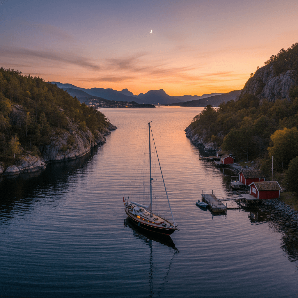
Lake Mjøsa by boat: Hamar, Helgøya, Gjøvik, Lillehammer
Lake Mjøsa is Norway's largest lake: 117 km long, 369 km² and around 450 metres deep at its deepest. From a boat you see the towns of Hamar, Gjøvik and Lillehammer, the farmland around Nes and the island of Helgøya, and the paddle steamer Skibladner, which has sailed on Mjøsa since 1856. Trips range from an hour along the Hamar waterfront to a full day north under the Mjøsa Bridge to Lillehammer. The southern part is open and wide; the northern end is narrow and more sheltered.
Where can you rent a boat near Lake Mjøsa?
Around Mjøsa, private owners rent out their own boats, and most are kept in or near the towns along the shore. Browse boats for rent in Hamar, boats for rent in Gjøvik, rent a boat in Ringsaker (Nes, Brumunddal and the Helgøya area) and boats for rent in Moelv. Each owner states what licence and experience they require, and some owners can come along as skipper.
6 boat trips on Lake Mjøsa
The distances below are estimated from the map and given in nautical miles (nm). Use a chart or a chart app when planning, and remember the 5-knot limit within 100 metres of land and piers.
1. The Hamar waterfront and Domkirkeodden
About 2 nm return from Tjuvholmen harbour, 30–60 minutes with stops. Tjuvholmen is the largest harbour on Mjøsa, with the restaurant Tjuvholmen kro, petrol and diesel, and a septic pump-out. From here you head west along the town, past Hamar Brygge and the Koigen park and beach, to Domkirkeodden, a museum and recreation area right on the water. Hamar Brygge harbour has 5–6 guest berths at the inner end and is only about 200 metres from the beach at Koigen, so you can combine a swim with a walk in town. Hamar municipality also has a guest pier at Mjøsfronten, where you may stay for one day.
Tip: We could not confirm a guest pier at Domkirkeodden itself. Moor in Hamar and walk the lakeside promenade. The protective building over the cathedral ruin (Hamardomen) has been closed for safety reasons since July 2025, so check domkirkeodden.no before you go.
2. Hamar to Helgøya and Nessundet
About 4 nm from Tjuvholmen, 15–20 minutes in a planing boat. Helgøya is Norway's largest freshwater island (18.3 km²) and lies where Mjøsa is at its widest. You head for Nessundet, the strait about 900 metres wide between Nes and the island, and tie up at Sund harbour just east of the Nessundet bridge. The restaurant Øya Maritim is at the harbour, which also has a swimming spot, a septic pump-out and room for up to about 100 guest boats when the weather allows. A grocery shop (Joker Tingnes) is just over the bridge.
Tip: The guest berths are on the breakwater and take wash from passing boats, so use good fenders and leave some slack in your lines.
3. Around Helgøya
About 10–12 nm around the island from Sund harbour, 1–2 hours with stops. You see the island's farmland from every side, with the old manor of Hovinsholm in the south and Bronze Age burial mounds at Steinsodden on the west side. On Skibladner's Nes days (Thursdays and Sundays in 2026) you may also see the paddle steamer on its way. Start and finish at Sund, where you can swim and eat.
Tip: The southern tip sticks out into the widest part of the lake. Choose which way round to go based on the wind, so the most exposed stretch comes while it is calmest.
4. Across the lake from Hamar to Gjøvik
About 11 nm, 35–45 minutes in a planing boat. This is the classic crossing of the lake, from the east shore to the west. Gjøvik harbour is right in town, next to the Skibladner pier, and is split into Nyhavna and Gamlehavna with 10–15 guest berths in total. Nyhavna has a petrol and diesel pump, and the harbour has a septic pump-out, showers and the restaurant Brygga. Gjøvik is Skibladner's home port, so in summer you will often see the paddle steamer at the quay.
Tip: Mooring inside the Skibladner boathouse (Skibladnerhuset) is not allowed. If a fresh southerly wind is forecast, cross early in the day.
5. Gjøvik to Kapp
About 7 nm south along the west shore, 25–35 minutes. Kapp harbour in Smørvika, Østre Toten, is next to the old Kapp dairy (Kapp Melkefabrikk), with the Mjøsa Museum (Mjøsmuseet), Kapp Båtkro and the restaurant Fjorn by the harbour. Guest berths are on the concrete pier at the entrance and on the breakwater, plus 10–12 berths just south of the Skibladner pier. The harbour also has a swimming spot.
Tip: Enter from the south, south of the Kapp light at the end of the breakwater. There are no entrance lights, so be in before dark on a late August evening.
6. Moelv, the Mjøsa Bridge and Lillehammer
About 13 nm from Moelv to Vingnes by Lillehammer, 40–60 minutes each way. Moelv harbour sits in a sheltered bay just south of Mjøsbrua, the 1,421-metre E6 bridge between Moelv and Biri. North of the bridge the lake narrows to about two kilometres, with hills on both sides up towards Lillehammer. Vingnes harbour by Lillehammer lies on the east side of the Vingnes point and has a long guest pier with 10–15 berths. The beach at Vingnesvika is about 300 metres away.
Tip: The Mjøsa Bridge has 15 metres of vertical clearance, so sailing boats must check their mast height. At Moelv there is a marked shoal about 100 metres west of the harbour entrance, and the southern half of the basin is very shallow.
| Route | Distance | Time | Highlight | Suits |
|---|---|---|---|---|
| Hamar waterfront and Domkirkeodden | approx. 2 nm return | 30–60 min | The town from the water, Koigen | Evening trip, families |
| Hamar–Helgøya (Sund) | approx. 4 nm | 15–20 min each way | Nessundet, Øya Maritim | Lunch trip |
| Around Helgøya | approx. 10–12 nm | 1–2 hours | Hovinsholm, Steinsodden | Half day |
| Hamar–Gjøvik | approx. 11 nm | 35–45 min each way | Crossing the lake, Skibladner | Experienced, calm weather |
| Gjøvik–Kapp | approx. 7 nm | 25–35 min each way | Mjøsa Museum, Kapp dairy | Day trip |
| Moelv–Lillehammer (Vingnes) | approx. 13 nm | 40–60 min each way | Mjøsa Bridge, the narrow north | Full day |
Rules and safety on Lake Mjøsa
- Speed limit: Max 5 knots within 100 metres of land, harbours, piers and other fixed or floating installations. The Mjøsa speed-limit regulation covers the municipalities around the lake and has applied since 1 January 2024. Scheduled traffic such as Skibladner is exempt.
- Toilets and grey water: Mjøsa is a drinking-water source; according to the water company HIAS it supplies about 80,000 people. Under the Norwegian regulation on environmental safety for ships (section 10), which also covers leisure boats, it is forbidden to discharge sewage, washing water and the like into inland waters. Use a pump-out station, for example at Tjuvholmen, Gjøvik, Moelv, Brumunddal or Sund on Helgøya.
- Wind and waves: The lake is up to 14–15 km wide and the usual wind is from the south. On that much open water, a steep chop can build when it blows. Check the forecast and save long crossings for calm spells.
- Fuel: You can fill up from the water at Gjøvik (Nyhavna) and Tjuvholmen in Hamar. The Norwegian Sea Rescue Society's boat Mjøsvekteren, based in Gjøvik, had 50 call-outs on Mjøsa from May to August 2026. Engine and gear problems were the most common cause, and running out of fuel came up again and again. Fill up before long trips.
- Water level: Mjøsa is regulated for hydropower, so the water level varies. This matters most in shallow harbours such as Moelv.
- Licence: Norwegian rules require a boating licence (båtførerbevis) for anyone born on or after 1 January 1980 who drives a boat over 8 metres or with more than 25 hp. Visitors should read our guide to the Norwegian boat licence to see how the rule applies to foreign renters.
Best time for a boat trip on Lake Mjøsa
In practice the boating season on Mjøsa runs from early summer to early autumn. July is peak season. In 2026 Skibladner runs its timetable from 23 June to 16 August, leaving Gjøvik at 09:30 Tuesday to Sunday. June brings long, light evenings and quieter guest harbours, and August and September are good for day trips with less traffic. Late in the season the evenings darken quickly and several harbours have no entrance lights, so plan to be in before dusk.
FAQ
Can I empty my boat toilet into Mjøsa?
No. Discharging sewage and washing water from boats into inland waters is forbidden, and Mjøsa is a drinking-water source as well. Use the pump-out at one of the harbours.
Where can I refuel from the water on Mjøsa?
Tjuvholmen harbour in Hamar has petrol and diesel, and Gjøvik harbour has a pump in Nyhavna. At Vingnes near Lillehammer the nearest filling station is about 300 metres from the harbour, so you would have to carry cans.
How deep is Lake Mjøsa?
The greatest measured depth is around 450 metres (Hamar municipality gives 453 m). Close to shore and in the bays it can still be shallow, so follow the navigation marks.
Where can I swim from the boat?
Many harbours around the lake have their own swimming spot, including Sund on Helgøya, Kapp and Brumunddal, and the Koigen beach is right by Hamar Brygge. Keep to 5 knots near the shore and swimmers, and respect private piers.
Can a sailing boat pass under the Mjøsa Bridge?
The bridge has 15 metres of vertical clearance. Boats with taller masts cannot go north towards Lillehammer.
Before you head out, see our packing list for a day trip by boat and what to check before renting a boat.