

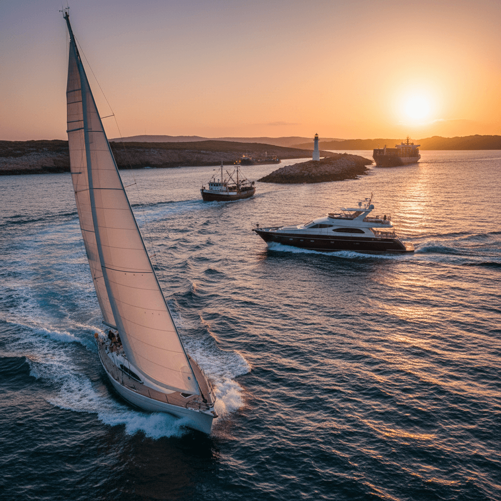
Sailing the Cyclades: a 7-day itinerary from Lavrion
The Cyclades are the classic Greek island-hopping area under sail: bare, white-village islands a day's sail apart, deep clear water and, in summer, the meltemi, a strong north wind that gives you fast reaching and sometimes a hard slog. A week from Lavrion usually takes you out to Kea, Syros, Tinos and Mykonos and back via Kythnos and Cape Sounion, around 130 nautical miles. The wind, not the map, decides the order.
Where to charter a yacht for the Cyclades?
The closest base to the Cyclades on the mainland is Lavrion, about 30 minutes from Athens airport, and you can also start from Syros or Mykonos in the middle of the islands; see all bases on our Greece yacht charter page. Charter weeks usually run Saturday to Saturday. For bareboat, the skipper needs a licence the charter company accepts (see boat licence in Greece and the ICC certificate); otherwise hire a skipper or book a crewed yacht.
A 7-day sailing itinerary from Lavrion
The route below goes east first, while the crew is fresh, then comes back west with the meltemi on the beam or behind you. The one leg you cannot avoid sailing into the wind is the last one to Lavrion, so keep it for the morning and keep a spare day in hand. Distances are approximate and estimated from the chart; plan with up-to-date charts and a pilot book.
Day 1: Lavrion to Kea (Vourkari)
Approx. 12 nm, an easy Saturday-afternoon start from Olympic Marine in Lavrion (VHF channel 9), which faces Kea, the Cycladic island nearest to Athens. The main port, Korissia, sits in the bay of Agios Nikolaos; the usual mooring for private boats is Vourkari, on the north-east side of the same bay, a little fishing village with tavernas. Tip: the ferries from Lavrio call at Korissia, so keep clear of the entrance when a ship is manoeuvring.
Day 2: Kea to Syros (Ermoupoli)
Approx. 33 nm, the longest leg, usually a beam reach in a northerly. Ermoupoli, the 19th-century marble town that was once Greece's first commercial port, is one of the country's biggest harbours, and you can berth there with protection in all weathers (VHF channel 12). Tip: with a less experienced crew, split this leg by stopping at Kythnos (Kea to Loutra approx. 14 nm, Loutra to Ermoupoli approx. 24 nm).
Day 3: Syros to Tinos
Approx. 12 nm, north-east, so often close-hauled. Leave early, before the wind builds in the afternoon. In Tinos town the eastern part of the old harbour is safe in all weathers, with a minimum depth of about 2 m; the ferries use the separate new harbour (VHF channel 12). Tip: walk up the marble-paved avenue to the Church of the Assumption.
Day 4: Tinos to Mykonos
Approx. 10 nm, downwind in a meltemi. Be clear about the harbour realities before you go: the Old Port by Chora does not accept sailing yachts at all, and yachts under 25 m go to the Tourlos marina north of Chora, which is described as quite crowded. Berths at Tourlos are booked online in advance, the fee is non-refundable, arrival is between noon and sunset, and the captain may not leave the island while the boat is moored. Tip: if you cannot get a berth, the bay of Ornos is described as well protected, and Agia Anna as sheltered from the etesians; or just visit for lunch and carry on.
Day 5: Mykonos to Syros (Finikas)
Approx. 23 nm west, round the south of Syros, typically a broad or beam reach in the meltemi. Finikas on the south-west coast has a small marina with about 25 places and offers relative protection from the meltemi. Tip: the village has a big beach, cafés and tavernas.
Day 6: Syros to Kythnos (Loutra or Kolona)
Approx. 22 nm to Loutra, about 26 nm to Kolona. The small marina at Loutra on the north-east side is protected from the etesians and has some facilities; the village is known for its hot springs, which is why Kythnos was once called Thermia. At Kolona a narrow sand strip creates two beaches side by side, and the bay is a very good anchorage protected from both the etesians and southerly winds. Tip: Merichas, the main port on the west side, has fuel and water and is also sheltered from the etesians.
Day 7: Kythnos to Lavrion via Cape Sounion
Approx. 24 to 27 nm north-west, the upwind leg. The wind is usually weakest in the night and morning, so cast off at first light. Pass under Cape Sounion, where the marble Temple of Poseidon, built around 444–440 BC, stands on the cliff; the ancient harbour was in the sandy cove north of the cape. Tip: if it is blowing hard, Kea (Kythnos to Korissia approx. 14 nm) is a safe halfway stop and leaves only approx. 12 nm to Lavrion.
Options: Serifos and Sifnos
If you would rather go south than to Mykonos, from Kythnos continue to Serifos (Merichas to Livadi approx. 16 nm), whose port Livadi is safe in all but southerly winds, and on to Sifnos (Livadi to Kamares approx. 12 nm), where Vathy is the island's safest harbour. Remember that every mile south is a mile you must sail back north into the meltemi.
| Leg | Distance | Overnight | Highlight |
|---|---|---|---|
| Lavrion to Kea | approx. 12 nm | Vourkari (Korissia bay) | Quiet first night close to base |
| Kea to Syros | approx. 33 nm | Ermoupoli town harbour | 19th-century marble town |
| Syros to Tinos | approx. 12 nm | Tinos town, old harbour | Church of the Assumption, marble villages |
| Tinos to Mykonos | approx. 10 nm | Tourlos marina (book online) or Ornos bay | Chora and Little Venice |
| Mykonos to Syros | approx. 23 nm | Finikas marina | Quiet beach village |
| Syros to Kythnos | approx. 22–26 nm | Loutra marina or Kolona anchorage | Hot springs, sand spit |
| Kythnos to Lavrion | approx. 24–27 nm | Base | Temple of Poseidon at Sounion |
Rules and safety in the Cyclades
The meltemi
The meltemi (the etesian winds) blows in the warm season and is strongest from mid-June to early September. It comes from the north-east in the northern Aegean and from the north in the central Aegean, typically at force 6 to 7 and sometimes 8 to 9 in the central Aegean, according to the National Observatory of Athens weather service meteo.gr. It is strongest around midday and in the afternoon and eases in the evening and at night. At their weather station on Tinos, days with gusts of 50 km/h or more average about 17 in July and 19 in August.
For your week: sail windward legs early in the day, never plan a long upwind leg for the last day, and choose each night's stop by the forecast. Shelter from the meltemi, according to the South Aegean islands tourism site: Koundouros, Pisses and Spathi on Kea; Merichas, Loutra, Kolona, Fykiada and Apokrousi on Kythnos; Finikas (relative) and Ermoupoli (all weathers) on Syros; Agia Anna on Mykonos; Koutalas and Livadi on Serifos; Cherronisos and Vathy on Sifnos. Otzias on Kea and Panormos on Mykonos are open to the north.
Check the forecast of the Hellenic National Meteorological Service (HNMS) every day at emy.gr/marine. The relevant sea areas are the Central Aegean, the Kafireas Strait (between Evia and Andros, north of your route) and the Saronic Gulf. HNMS points out that gusts may be 40 per cent stronger than the forecast wind.
Port rules and ferries
- The island harbours are ferry ports: ferries link Kythnos and Kea with Lavrio, and Tinos with Piraeus, Rafina, Syros and Mykonos. At Tourlos in Mykonos, yacht movements can be restricted while ferries manoeuvre. Never block a harbour entrance, and call the port on VHF channel 12 where one is given.
- Mykonos: yachts under 25 m moor at Tourlos by online reservation only; sailing yachts are not allowed in the Old Port. Read the current rules on the Mykonos Port Fund site.
- Bathing areas: under the Hellenic Coast Guard's General Port Regulation no. 20, keep at least 200 m from where people swim and do no more than 5 knots within 200 m of the shore.
- Posidonia: the seagrass meadows around Kea are among the Mediterranean's most important ecosystems and are being mapped and protected by the municipality of Kea. Drop your anchor on sand, not on the seagrass.
Licence
Without a licence you may only drive small motorboats in Greece (outboard up to 30 hp on a conventional hull, only 15 hp on a RIB, V-hull or multihull). For a bareboat charter the skipper needs a recognised licence (the ICC is the safest choice) and the charter company checks it. With a hired skipper nobody on board needs one. Details: boat licence in Greece.
Best time to sail the Cyclades
The charter season runs roughly from April or May to October. For most crews the best months are May, June, September and October: warm, with steady sailing winds and usually fewer days of strong meltemi. July and August are the meltemi months, with most days of strong wind; they suit experienced crews who plan around the forecast. June gives long days before the peak of the meltemi; October brings shorter days, so plan shorter legs. For how the Aegean compares with the Adriatic, read Greece or Croatia: meltemi and best time.
FAQ
Is the Cyclades suitable for a first bareboat charter?
It can be, in May, June, September or October with a crew that has sailed in 5 to 6 Beaufort. In July and August the meltemi often blows 6 to 7, so a first-timer is better off with a hired skipper.
Can I moor a sailing yacht in Mykonos town?
Not in the Old Port by Chora, which is for motor yachts over 25 m only. Sailing yachts go to the Tourlos marina, which must be booked online in advance, or anchor in a sheltered bay such as Ornos.
Why sail east first from Lavrion?
Because the islands lie south-east of the base and the meltemi blows from the north. Going out, most legs are reaching; the last leg home to Lavrion is the only one that is regularly upwind, so it should be short and sailed in the morning.
What if the meltemi is too strong to leave port?
Stay put. Ermoupoli and the eastern part of Tinos harbour are safe in all weathers, and Loutra and Merichas on Kythnos are sheltered from the etesians. Keep one spare day in the plan so you can wait for the wind to ease before the return to Lavrion.
How long is the sail from Lavrion to Kea?
About 12 nautical miles to Korissia or Vourkari, which makes Kea an easy first night after a Saturday check-in.
More sailing guides
Want to explore further into the islands? Read our guide to sailing Paros, Naxos and the central Cyclades, or for a gentler week from Athens, the Saronic Gulf sailing week.



