

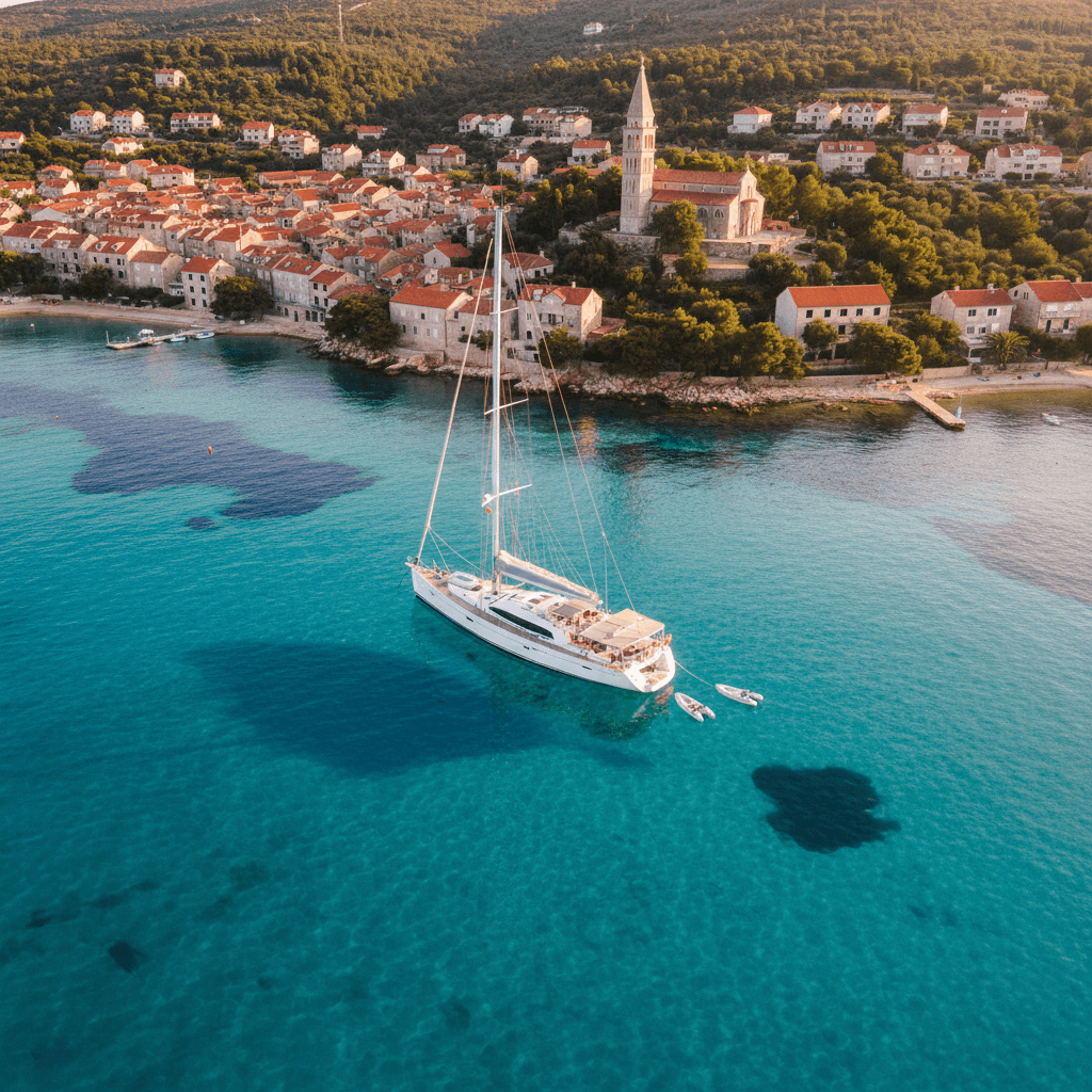
Sailing the Saronic Gulf: a 7-day itinerary from Athens
The Saronic Gulf is the easiest sailing area to reach in Greece: you can leave from a marina on the Athens Riviera on your first afternoon. The legs are short, mostly 10 to 25 nautical miles, and each night ends in a different harbour. A typical week loops from Athens to Aegina and Agistri, through the narrow channel at Poros, on to car-free Hydra and back past the volcanic Methana peninsula. The meltemi usually blows harder in the Cyclades.
Where to charter a yacht for the Saronic Gulf?
Most Saronic charter weeks start from the marinas south of Athens. The largest is Alimos Marina, which calls itself the biggest marina in Greece, with about 1,100 berths and its own charter area. Compare charter yachts in Athens, boats on Salamina and yachts in Porto Heli, a mainland base close to Spetses. The Greece page lists every region. You can book on Ship O'Hoi, bareboat or with a skipper. Charter weeks usually run Saturday to Saturday. To sail bareboat, the skipper needs a licence the charter company accepts: see our guides to the boat licence in Greece and the ICC certificate. If nobody in your crew has one, hire a skipper or book a crewed yacht.
A 7-day sailing itinerary from Athens
This loop starts and ends at Alimos Marina. Distances are rough estimates from the chart. Plan each day with charts, a pilot book and the morning forecast.
Day 1–2: Alimos to Aegina
Approx. 17 nm. After Saturday check-in, most crews spend the first night in the marina at Alimos. It lies about 8 km south of the port of Piraeus and about 30 km from the airport, and the marina office listens on VHF channel 71. On Sunday, head south-west across the gulf to Aegina, the second-largest island in the Saronic. Coming into the harbour, you see neoclassical houses along the waterfront and the white chapel of Agios Nikolaos Thalassinos. Overnight in Aegina town harbour. The Municipal Port Fund of Aegina runs the harbour and takes berthing requests. Tip: try the island's famous pistachios, and if you have a spare morning, visit the Doric Temple of Aphaia near Agia Marina on the east coast.
Day 3: Aegina to Agistri and Perdika
Approx. 6 nm to Agistri, then approx. 5 nm to Perdika. Agistri is Aegina's small, green neighbour, with pine trees that reach right down to the water. The bays of Dragonera and Chalikiada are good for a swim, but anchor only when the weather allows. In the afternoon, cross to Perdika at the southern tip of Aegina. The port fund says its little harbour is a regular stop for large and small pleasure craft, and it is lined with fish tavernas. Overnight in Perdika harbour. Tip: the islet of Moni lies just opposite and is home to deer, peacocks and wild goats. In summer, boats run across from Perdika many times a day.
Day 4: Perdika to Poros
Approx. 13 nm. Sail south past the Methana peninsula to Poros. The town sits on a narrow sea channel. According to the Region of Attica, an earthquake around 400 AD left this channel between the island and Galatas on the mainland. Ferries cross it to Galatas. Overnight on the Poros town quay. The Municipal Port Fund of Poros offers stern-to or alongside berths, and alongside costs more. Catamarans pay a surcharge. Water and electricity come from pillars that only port staff operate, from 09:00 to 21:00 in the April–October season. Call them on VHF channel 9. Tip: swim at Russian Bay, west of the harbour. The ruins there belonged to a 19th-century Russian naval supply base. The little islet of Daskalio, with its tiny church, is a short swim across the cove.
Day 5: Poros to Hydra
Approx. 12 nm. Cars and motorbikes are banned, and people get around on foot or by donkey. The town rises like an amphitheatre around a harbour that the Greek National Tourism Organisation describes as "filled with yachts and traditional fishing boats". Mooring in the harbour is handled by the Port Authority of Hydra, which is also where you pay port dues, so bring the boat's papers. Arrive early in the afternoon to find space. Tip: if the harbour is full or a swell is running in, have a plan B. Ermioni on the mainland opposite is approx. 10 nm to the west.
Day 6: Hydra to Methana (Vathy)
Approx. 24 nm, one of the two longest legs, so set off in the morning. Sail back north past Poros to the Methana peninsula, a volcanic landscape whose last eruption was near Kameni Chora in the 3rd century BC. Overnight at Vathy on the west coast. The Region of Attica describes it as a fishing village with a natural harbour, safe from winds. Tip: a footpath from Kameni Chora climbs for about 25 minutes to the rim of the largest crater, over old red lava flows. The peninsula's thermal springs have been used for thousands of years.
Day 7: Methana back to Alimos
Approx. 26 nm. Cross the gulf, passing north of Aegina, and make a last swim stop on the way. Most yachts must be back at base on Friday evening for Saturday check-out. Keep a sharp lookout for ships off Piraeus.
Variation: Epidavros, Spetses, Dokos and Ermioni
With an extra day, sail approx. 9 nm west from Vathy to Palaia Epidavros. This seaside village stands on the site of the ancient city, and its Little Theatre of Ancient Epidaurus still hosts festival performances. If you start from Porto Heli instead, the southern islands are close. The municipality calls Porto Heli's enclosed bay the most sheltered harbour in the Argolida. Spetses lies just across the water to the south. It has been car-free since 1967, and every September the Armata festival re-enacts the island's 1822 naval battle. Dokos lies between Hydra and the Argolid coast. In its Skintos Bay, divers found a wreck whose cargo dates to around 2200 BC. Ermioni, with its small harbours (mandrakia) below the Bisti headland, makes a relaxed last night before you head back to Porto Heli.
| Leg | Distance | Overnight | Highlight |
|---|---|---|---|
| Alimos – Aegina | approx. 17 nm | Aegina town harbour | Agios Nikolaos chapel, pistachios |
| Aegina – Agistri – Perdika | approx. 6 + 5 nm | Perdika harbour | Dragonera swim, Moni islet |
| Perdika – Poros | approx. 13 nm | Poros town quay | Channel to Galatas, Russian Bay |
| Poros – Hydra | approx. 12 nm | Hydra harbour (plan B: Ermioni) | Car-free harbour town |
| Hydra – Methana (Vathy) | approx. 24 nm | Vathy harbour | Volcano hike from Kameni Chora |
| Methana – Alimos | approx. 26 nm | Alimos Marina (base) | Last swim stop off Aegina |
Rules and safety in the Saronic Gulf
Ships and ferries. Piraeus, at the head of the gulf, is the largest passenger port in Europe. Its port authority counts about 20 million passengers a year, and about 8 million of them are on the short Salamina–Perama ferry crossing alone. Ferries run from Piraeus to the Saronic islands, and container ships and cruise ships use the same approaches. Keep a proper lookout, cross shipping routes at right angles and never assume a ferry has seen you. Ferries also run through the Poros channel and into the harbours of Aegina and Hydra, so leave the ferry quays clear.
Port authorities and harbour dues. Each harbour has its own rules. In Aegina and Poros, the municipal port funds manage the berths and charge fees. In Hydra, you pay dues at the port authority. Every charter in Greece files an electronic crew list before departure, and everyone on board must carry a passport or ID card.
Swimmers and beaches. Under the Hellenic Coast Guard's General Port Regulation no. 20, rental motorboats must stay at least 200 m away from where people swim and do no more than 5 knots within 200 m of the shore. Use the same limits for your dinghy.
The meltemi. The Etesians, or meltemi, are northerly summer winds that the Hellenic National Meteorological Service says blow mainly in the Aegean. A peer-reviewed study finds their peak intensity and persistence in July and August, with winds over the Aegean often above 15 m/s (about 29 knots). Research describes them as strongest over the eastern Greek seas and weaker towards the west. The Saronic, between Attica and the Peloponnese, usually gets less of the meltemi than the Cyclades, but strong northerlies do still reach it. Check the forecast every morning, and don't overnight in an open bay when a blow is due.
Licence. In Greece, only small motorboats are licence-free: an outboard of up to 30 hp on a conventional hull, and only 15 hp on a RIB, V-hull or multihull. On a bareboat charter, the skipper needs a recognised licence (the ICC is the safest choice), and the charter company checks it at the base. With a hired skipper, nobody on board needs a licence. Details are in our Greece licence guide.
Emergencies. The Hellenic Coast Guard's emergency number is 108. At sea, call on VHF channel 16, the international distress channel.
Best time to sail the Saronic Gulf
The sailing season runs roughly from April or May to October. Poros, for example, runs its high-season port service from April to October. July and August bring the strongest and most persistent meltemi, so plan shorter legs and arrive in harbour early. June and September lie either side of that peak. October is a good shoulder month: the Etesian season usually fades in the second half of September, and the rainier season starts only in mid-October. Days are shorter, though, so check with your base about the season before you book.
FAQ
How long does it take to sail from Athens to Hydra?
Hydra is roughly 35 nm from Alimos in a straight line, and more by the island route. Most crews reach it on day four or five, after stops in Aegina and Poros. A motor yacht can do it in a day.
Is the Saronic Gulf good for a first bareboat charter?
Yes, it is one of the easier areas in Greece: short legs, many harbours and usually less meltemi than the Cyclades. You still need to be confident mooring in crowded harbours, and the skipper needs a licence the charter company accepts.
Can I start a Saronic week from Porto Heli instead of Athens?
Yes. Porto Heli sits at the southern end of the area, so Spetses, Dokos, Hydra and Ermioni are all short legs away. From there, Aegina is the far end of the week instead of the start.
Can you sail the Saronic Gulf in October?
Yes. The Etesian season usually ends in September. The Hellenic National Meteorological Service counts April to October as Greece's warm, dry season, with the rainier season starting in mid-October, so plan with the forecast.
Do I need to book berths in the Saronic harbours?
Aegina's port fund takes berthing requests. Elsewhere, ask the port fund or port authority when you arrive. In high summer, arrive by early afternoon, especially in Hydra.
Heading further out? Read our guides to sailing the Cyclades from Lavrion and Paros and Naxos.



