

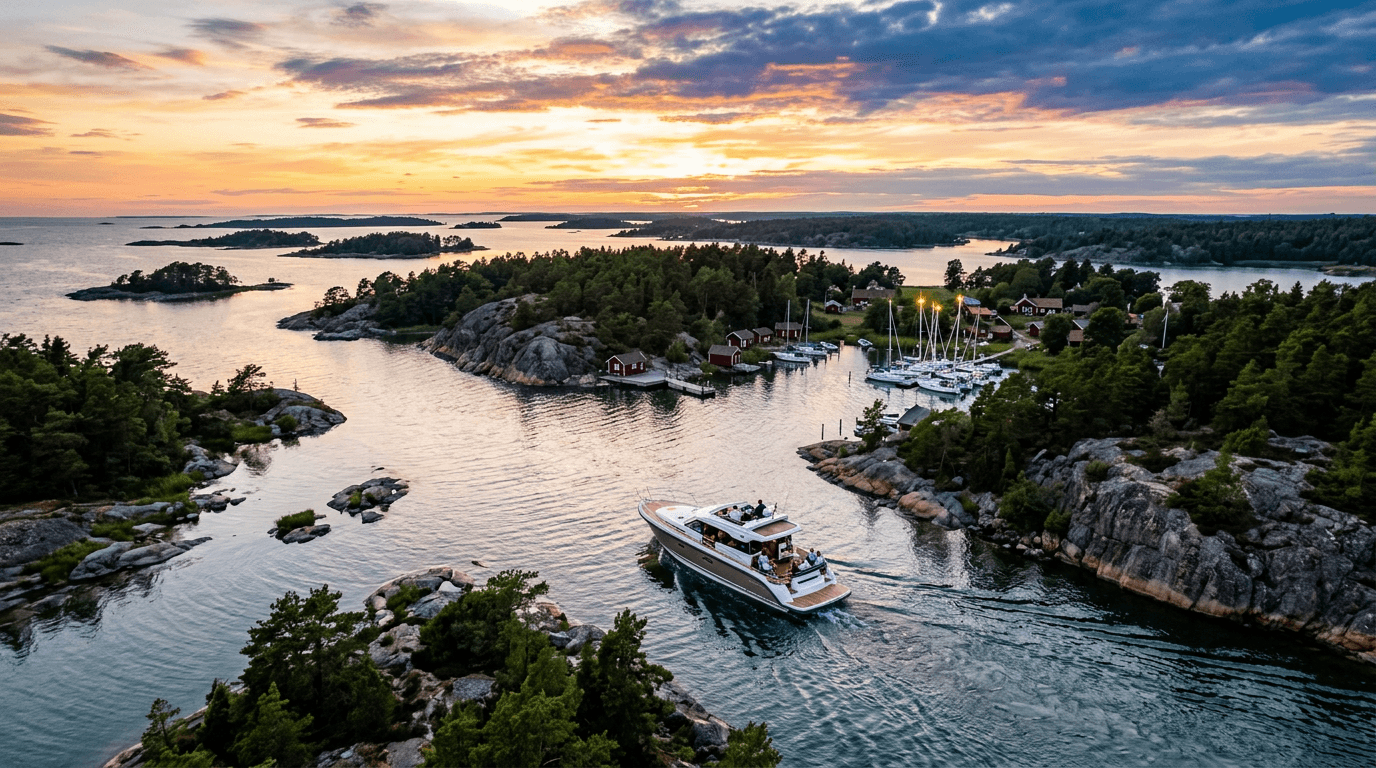
Kimitoön and the Archipelago National Park by boat
Kimitoön (Kemiönsaari in Finnish) is the eastern gateway to Finland's Archipelago National Park. From the old ironworks village of Dalsbruk and the full-service harbour at Kasnäs, a short run takes you to the former fortress island of Örö, the Rosala Viking Centre, the sandy bays of Högsåra and national-park islands where there is nothing but rock, heath and sea. Distances are short and harbours close together, so day trips suit first-timers too. Further south and west the islands thin out and the open Baltic makes itself felt.
Where can you rent a boat near Kimitoön?
Private owners rent out their own boats around Kimitoön, and the handiest starting point is boats in Dalsbruk, close to Kasnäs and the national park. On the mainland side you can also rent a boat in Salo: the sea area off Salo town is Halikonlahti bay, and the town has a guest pier for short stays in the Salo river (Salonjoki). Each owner states in the listing what experience or certificate they require, and some owners can come along as skipper.
6 boat trips in Kimitoön
Distances are rough estimates in nautical miles (nm). Always check the route on a nautical chart or chart app, as the archipelago is full of shallows. A "vierasvenesatama" (Swedish: gästhamn) is a guest harbour where visiting boats can moor for a fee, usually with sauna, showers and waste disposal.
1. Dalsbruk to Kasnäs
Approx. 9 nm from Dalsbruk guest harbour to Kasnäs, about 40 minutes by motorboat or 2–3 hours under sail. Dalsbruk's harbour sits in the middle of the old ironworks village, with sauna, showers, a laundry room and a septic pump-out. Along the 100-metre breakwater there is plenty of room for day visitors. Kasnäs is a modern marina on the Hanko–Utö fairway with about 100 guest berths, fuel sales around the clock all year, a village shop, a restaurant and a spa.
Tip: refuel and stock up in Kasnäs before heading out, because the national-park islands have no drinking water.
2. Kasnäs to Örö fortress island
Approx. 7–8 nm south-south-west of Kasnäs, 30–40 minutes by motorboat. Örö was a closed military fortress until 2015. Its first structures date from the 1910s, when it was part of Peter the Great's chain of naval fortresses. Today it belongs to the national park, with two marked trails, old bunkers, sandy beaches in the Solkuro and Balget bays and more than 1,700 recorded butterfly species. The guest harbour lies in Gölen bay on the east shore and has about 80 berths with boom, buoy and side mooring. It is open all year, and the island has restaurants.
Tip: anchoring is forbidden in the harbour and in the waters around Örö. On busy summer days, call the harbour or book a berth in advance.
3. Kasnäs to Rosala and Hitis
Approx. 5 nm south from Kasnäs to Rosala village bay, 20–30 minutes by motorboat. The Rosala Viking Centre has a museum, a Viking village and a café, and Viking-age finds have been made at Kyrksundet in Hitis (Hiittinen). There are two piers in the village bay where you may moor for a day visit, 200 metres from the centre. They are open to everyone and half of one pier is kept for connecting boats, so it can get crowded in summer. For an overnight stay, the TB-Marin guest harbour in the next bay to the north, about 2 km from the centre, is the better choice.
Tip: the centre is open mainly in summer, so check opening hours on rosala.fi before you set off.
4. Holma and Högsåra: a short loop from Kasnäs
Approx. 6–7 nm round trip, 2–4 hours with stops. Holma is a national-park island about 1 km south-west of Kasnäs. Its excursion harbour, with a small jetty, is in Byvik bay on the south shore, and the island has two nature trails. Högsåra has three harbours: Kejsarhamnen on the north shore, and Lillbacka Brygga and Cafébryggan on the east shore. Cafébryggan connects to Farmors Café. On the west shore, Sandvik is a national-park sandy beach without a jetty. Landing a small boat on the sand is easy, but the bay is open to westerly winds.
Tip: at Lillbacka Brygga, leave space for the Svartnäs ferry at the ferry landing.
5. Dalsbruk to Söderlångvik and Sandön
Approx. 6–8 nm one way depending on the route, 1–2 hours. Söderlångvik has a guest harbour. Sandön, in the national park, is part of the Salpausselkä ridge, like Jurmo, and its eastern tip continues as a long, shallow sandbar. Small boats can land in the bay at the north-east corner, and larger boats can lie at anchor. The spot is fairly sheltered.
Tip: Metsähallitus advises taking the sandbar off the eastern tip into account when navigating, so give it a wide berth.
6. The outer archipelago: Vänö and Yxskären
Approx. 8 nm from Kasnäs to Vänö and about 4 nm further west to Yxskären, roughly an hour each way by motorboat. Vänö has a guest harbour. Yxskären is a national-park island with a nature trail around a small lagoon lake. The excursion harbour is on the east shore, where you moor with an anchor and a line ashore, using the mooring rings on the rocks. The water there is 1.5–2 m deep. Out here the islands thin out and the swell from the open sea is noticeable, so go only in settled weather and in a boat built for open water.
Tip: the Vänö restricted area islets are closed to landing from 1 April to 31 July, so plan your stops in advance.
| Route | Distance | Time | Highlight | Suits |
|---|---|---|---|---|
| Dalsbruk–Kasnäs | approx. 9 nm | 40 min–3 h | Ironworks village, full-service harbours | Everyone |
| Kasnäs–Örö | approx. 7–8 nm | 30–40 min | Fortress island, butterflies, beaches | Day trip or overnight |
| Kasnäs–Rosala | approx. 5 nm | 20–30 min | Viking Centre | Families |
| Holma and Högsåra | approx. 6–7 nm | 2–4 h | Nature trails, Sandvik beach | Short trips, small boats |
| Dalsbruk–Sandön | approx. 6–8 nm | 1–2 h | Salpausselkä ridge, sheltered cove | A quiet day |
| Kasnäs–Vänö–Yxskären | approx. 12 nm | approx. 1 h each way | Bare outer islands | Experienced crews, good weather |
Rules and safety in Kimitoön
Finland's everyman's rights apply in the Archipelago National Park, but the park regulations (in Finnish) restrict them. Metsähallitus keeps current information on Luontoon.fi.
- Bird nesting season: in several restricted areas, landing, moving about and flying drones are banned from 1 April to 31 July. On the Kimitoön side this includes the Vänö restricted area (islets such as Långa Måsskär, Höga Måsskär and Västra Måsskär). Some areas close from 1 February, and a few are off-limits all year. The exact boundaries are on the map annexed to the regulations.
- Camping and fires: camping is allowed only at designated campsites, and fires only at marked fireplaces using the firewood provided. Camping stoves are allowed elsewhere. At campsites and excursion harbours, quiet hours are 23:00–07:00.
- Nature: picking berries and mushrooms is allowed, taking plants is not. Keep dogs on a leash.
- No anchoring at Örö: anchoring is forbidden in the harbour and the surrounding waters.
- Everyman's rights: according to Luontoon.fi, everyman's rights do not let you cross private yards or disturb people's home peace, and they do not apply as such in national parks. Keep well away from homes on private shores.
- Speed and fairways: Traficom points out that speed limits are signed in km/h, even though boat speed is usually given in knots. Kasnäs is a ferry port with connecting boats to Rosala and Örö. Keep to the right-hand side of fairways and give way to ships in narrow channels.
- Toilet waste: emptying toilet waste into the sea is prohibited. Use the pump-out stations, for example at Dalsbruk, Kasnäs and Örö.
- Licence: as explained in our guide to boat licence rules in Finland, Finland has no compulsory boat licence for leisure boats up to 24 m. A motorboat that must be registered (engine of 15 kW or more, or hull 5.5 m or longer) may only be driven by someone aged 15 or over. Owners may ask about your experience, as Traficom advises boat lenders to do.
- Alcohol: Traficom gives the limit for drink-driving on the water as 1.0 per mille.
Best time for a boat trip in Kimitoön
The Kasnäs, Dalsbruk and Örö harbours are open all year and welcome boats from early spring to late autumn. The main summer season with full services usually runs from June to the end of August. That is when the tourist information point operates at Dalsbruk guest harbour and the Rosala Viking Centre is open. In spring and autumn the Kasnäs harbour office is mainly staffed at weekends. August is a good month for the outer islands, because the bird-season landing bans end on 31 July and the harbours are quieter. Always check current opening hours on the harbours' own websites.
FAQ
Do I need to book a berth at Örö?
Usually not. Berths are filled in order of arrival, and in summer the harbour staff help you moor. You can also book in advance. Day visits of more than three hours are charged too.
Can I stay overnight on my boat in the national park?
Yes, in excursion harbours and guest harbours, unless the area is under a movement restriction. Respect the quiet hours from 23:00 to 07:00. Tents may only be pitched at designated campsites.
How far is Örö from Kasnäs?
About 12 km (under 7 nm) in a straight line to the south-south-west. Following the fairway it is roughly 7–8 nm.
Is there drinking water on the national-park islands?
According to Luontoon.fi, most excursion islands, including Holma, Sandön and Yxskären, have no drinking water. Fill your tanks in Kasnäs, Dalsbruk or Örö.
Can I get to Rosala without my own boat?
Yes. A free ferry runs from Kasnäs all year and takes about 30 minutes. From the ferry it is 5 km to the Viking Centre.
If you want to carry on west towards Nagu, Korpo and Jurmo, read the Turku archipelago by boat. Heading east, Hanko and the Raasepori archipelago by boat covers the next stretch of coast.



