

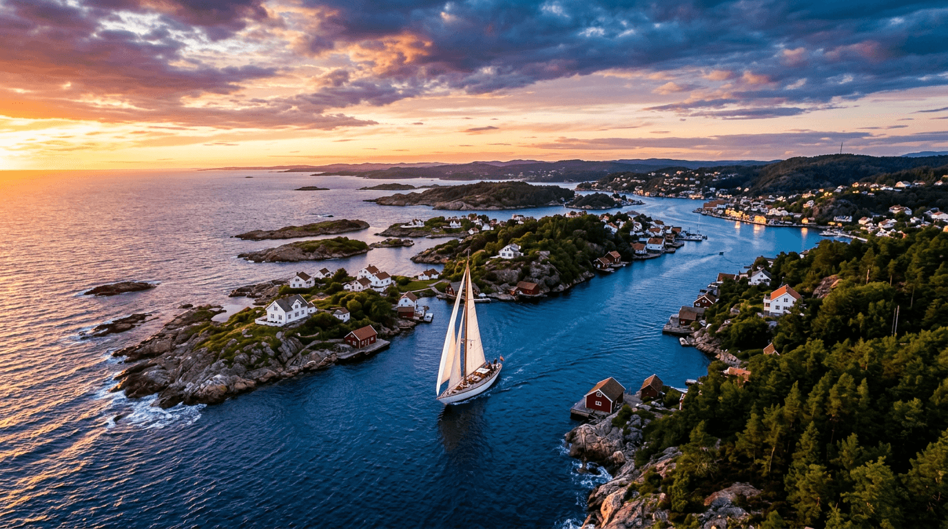
The Kragerø archipelago by boat: routes and harbours
The Kragerø archipelago has 495 islands, islets and skerries, and much of the best is a short ride from town. With a boat you can reach Jomfruland National Park and its long pebble beach, slip through the narrow Eidkilkanalen canal on Skåtøy, climb to the viewpoints on Gumøy and visit the old outport of Portør. This guide gives you five routes with distances, stops and the rules that actually apply on the water around Kragerø.
Where can you rent a boat in Kragerø?
Private owners rent out their own boats in and around Kragerø. Browse boats for rent in Kragerø, or look at boats for rent in Stabbestad just south of town and boats for rent in Sannidal at the head of Kilsfjorden. Each owner states their own licence and experience requirements in the listing, and some owners can come along as skipper.
5 boat trips in the Kragerø archipelago
The distances below are rough estimates in nautical miles (nm) from the map. Use a nautical chart or a chart app to plan and navigate.
Jomfruland and Stråholmen
From the guest harbour (gjestehavn, a harbour with short-stay berths for visiting boats) in central Kragerø it is approx. 7 nm to Tårnbrygga on Jomfruland, and approx. 3 nm further north to Stråholmen. Allow a full day. Jomfruland is part of the Raet, an ice-age moraine, with a 7 km pebble beach on its seaward side, two lighthouses from 1838 and 1939, and rich birdlife. The national park covers approx. 117 km², but only around 2 percent of it is land.
- Stop: Jomfruland guest harbour at Tårnbrygga has 50 guest berths, power, water, toilets, showers and laundry, plus a sandy beach and a summer restaurant. Visit Telemark lists a 35 ft maximum for leisure boats.
- Stråholmen: 2 km north of Jomfruland. The stone breakwater, built by the state and completed in 1892, is a good place to moor. The island has only holiday homes, and birdwatching is best from late May to early June.
- Tip: Several islets and skerries by Stråholmen, and Kråka at the north end of Jomfruland, are seabird zones (zone B). From 15 April to 15 July you must stay at least 50 metres from land there. Check the national park map before you go.
Eidkilkanalen and Skåtøy
Skåtøy is the largest island in the archipelago, with around 250 year-round residents. From Kragerø it is approx. 2 nm to Eidkilkanalen, a man-made canal that splits the island in two. Work began in 1924, and the canal opened itself in 1936 when ice broke the dam. On the rock face at the entrance you will see the Eidkil troll. A loop takes 1–3 hours, longer if you go ashore.
- Stop: Skåtøybrygga is a public pier, and you can moor on the inside. Skåtøy Kafé has boat spaces there for its guests, five minutes' walk from the café, which is open from Easter to autumn.
- See: The "archipelago cathedral", one of Norway's largest wooden churches, and Krikken coastal fort from the Second World War at the far end of the island (approx. 3–4 nm from town). Bring a torch for the tunnels.
- Tip: A 5-knot limit applies all year from Eidkilkanalen to Åsvika. Take it slowly and enjoy the passage.
Gumøy and Signalen
The guest pier at Tangane on Gumøy is approx. 4 nm from Kragerø. From here you walk up to Vestre Gumøyknute, also called Signalen (113 m), with a restored coast-watch station and a free telescope over the islands. Østre Gumøyknute is 107 m. A 3 km cultural trail has signs on local history, geology and wildlife. Allow half a day.
- Stop: The guest pier at Tangane is meant for day visits. Overnight stays are at the discretion of the pier's managers.
- Combine: From Tangane it is approx. 3 nm on to Tårnbrygga on Jomfruland.
- Tip: The car ferry from Kragerø docks at the ferry berth at Tangane. Keep it clear.
Stabbestad, Portør and Stangnes
This route heads south along the mainland. Stabbestad is approx. 1.5 nm away, Portør approx. 5 nm and Stangnes approx. 6–7 nm. Portør is an old outport (a sheltered harbour on the outer coast) mentioned in Snorri's sagas, with an old pilot station and a reconstructed optical telegraph from 1808. Stangnes is one of Kragerø's finest outdoor areas, with smooth rocks and swimming spots. Both belong to the municipal archipelago park.
- Stop at Stabbestad: There are boat spaces by the beach club at Kragerø Resort and next to the ferry berth. Vestre Stabbestad has a lawn, a sandy beach and a boat and swimming spot with a diving board.
- Portør: The municipality runs a service building here with a toilet, washing machine and tumble dryer.
- Tip: Portør has a 5-knot limit from 20 June to 20 August, and Haslumkilen and Levangkilen are 5 knots all year.
Kilsfjorden to Kil in Sannidal
Kilsfjorden is a long, narrow fjord running from Kragerø to Kil. Kil and Sannidal are the oldest settlements in the municipality, and the fjord was Sannidal's route to the sea. Kil is approx. 6 nm away. The whole trip is in sheltered inner waters and makes a good alternative to the outer routes. The round trip takes 2–3 hours.
- Stop: We have not been able to confirm a guest pier in Kil. Treat it as a round trip and eat in Kragerø town afterwards.
- Tip: Inside a marked line in Kilsfjorden, a 5-knot limit applies from 20 June to 20 August.
| Route | Distance (approx.) | Time | Highlight | Suits |
|---|---|---|---|---|
| Kragerø – Jomfruland – Stråholmen | 7 nm + 3 nm | Full day | Pebble beach, lighthouses, birds | Larger boats, good weather |
| Kragerø – Eidkilkanalen – Skåtøy | 2–4 nm | 1–3 hours | The canal, Eidkil troll, Krikken | Everyone, small boats too |
| Kragerø – Gumøy (Tangane) | 4 nm | Half day | View from Signalen | Boat plus a hike |
| Kragerø – Stabbestad – Portør – Stangnes | 1.5–7 nm | Half to full day | Outport, smooth rocks, swimming | Families |
| Kilsfjorden to Kil | 6 nm | 2–3 hours | Narrow inner fjord | A calm fjord trip |
Rules and safety in Kragerø
Jomfruland National Park covers Jomfruland, Stråholmen and large areas of sea. The rules are set out in the protection regulation for Jomfruland National Park and explained on the national park's own website:
- Zone B (seabirds): From 15 April to 15 July you may not travel on land, or at sea closer than 50 metres from land, in zone B. This covers 15 named areas, including Kråka at the north end of Jomfruland, Beverskjæra, Skadden, Stråholmsteinen and Rauane. It applies to paddling and diving too.
- Slow down and give seabirds space all year.
- Dogs must be on a leash all year.
- Camping and tents are not allowed in zone B or on Stråholmen, and you may not light fires or put a grill directly on the ground.
- Motorised model aircraft and similar devices are banned.
Speed limits: According to Kragerø municipality, the limit is 30 knots all year in all sheltered waters, out to 100 metres beyond the outermost skerries. A 5-knot limit applies all year in places such as the inner harbour, Eidkilkanalen–Åsvika and Kirkesund. From 20 June to 20 August it is 5 knots in places such as Kilsfjorden, Portør, Knipsund and Havnefjorden. The municipality recommends the Norwegian Coastal Administration's BåtFart app to check the limit where you are.
Ferry traffic: Ferries from Kragerø serve Stabbestad, Skåtøyroa, Gumøy and Jomfruland. Keep your distance and keep the quays clear.
Licence: Norwegian rules require a boating licence (båtførerbevis) for anyone born on or after 1 January 1980 who drives a boat over 8 metres or with more than 25 hp. Visitors should read our guide to the Norwegian boat licence to see how this applies to foreign licences.
Best time for a boat trip in Kragerø
The guest harbours in town have their main season from 15 March to 1 November. On Jomfruland, the first floor of the service building opens on 16 April, and the full facility is open from 20 June to 20 August. That is also when most summer speed limits apply and the water is busiest. Early summer is good for birds, but remember the zone B restrictions until 15 July. Outside the summer season there is less open ashore, so check opening hours before you go.
FAQ
Can I moor my own boat on Jomfruland?
Yes. Jomfruland guest harbour at Tårnbrygga has 50 guest berths with power and water. You can also moor at the stone breakwater on Stråholmen.
How do I pay harbour fees in central Kragerø?
At both Barthebrygga/Gunnarsholmen and Jernbanekaia you pay at a machine with a bank card or in the Marina Booking app. Water and power are included.
Can I go ashore anywhere in the national park?
Not in zone B between 15 April and 15 July, where you also cannot come closer than 50 metres to land. The rest of the year, and outside zone B, the general rule is to move carefully and respect wildlife.
Where can I swim from a boat?
Stangnes has smooth rocks and swimming spots. Vestre Stabbestad has a sandy beach and a diving board, and there is a sandy beach by Tårnbrygga on Jomfruland.
Is there one speed limit for the whole archipelago?
No. The general limit is 30 knots, but many sounds, inlets and harbours are 5 knots, some all year and some only in summer. Check the BåtFart app.
To continue along the coast, read about Lyngør, Risør and Tvedestrand by boat to the south or Grenland by boat to the north. Our packing list for a boat day trip is handy before you set off.



