

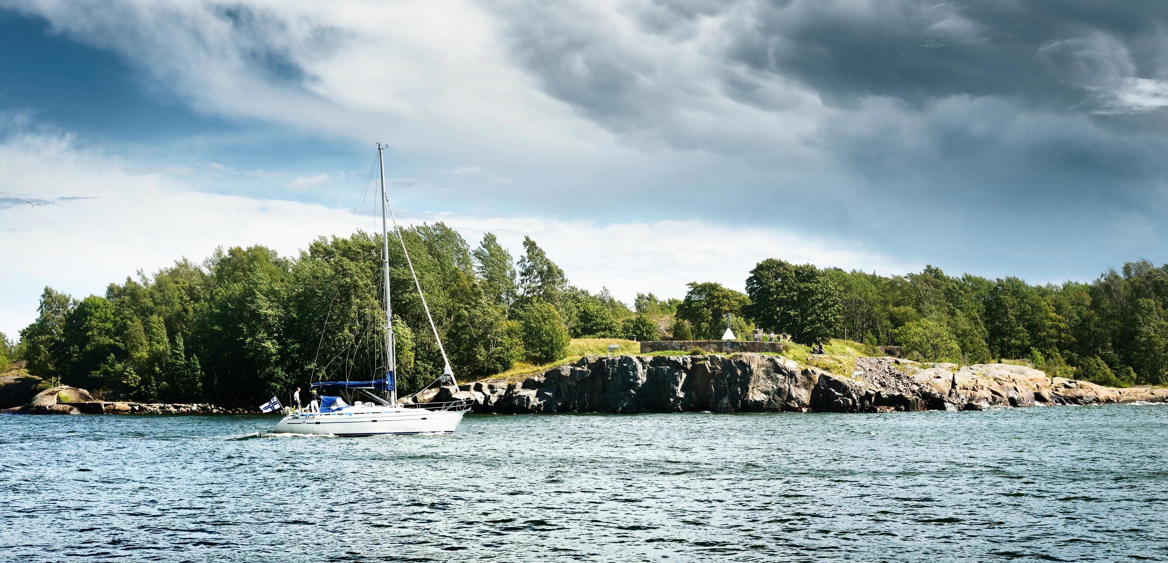
Sailing Elba and the Tuscan Archipelago: 7-day route
Elba is the easiest big island in Italy to reach under sail: from the Tuscan mainland it is only a short crossing, and once there you have sheltered town harbours on every side, the wild volcanic island of Capraia a day's sail away and Corsica on the horizon. A typical week is a loop of short and medium legs: Portoferraio, Marciana Marina, Capraia, the south coast of Elba and Porto Azzurro, then back across the Piombino channel to the mainland.
Where to charter a yacht for Elba and the Tuscan Archipelago?
The closest bases are on the mainland opposite Elba: yacht charter in Piombino is the shortest hop, San Vincenzo is a little further north, and Punta Ala lies east of Elba with a direct run to Portoferraio or Porto Azzurro. From Castiglioncello the first leg is longer (approx. 35 nm to Portoferraio), and the boats across Tuscany page shows every base in the region. Charter weeks usually run Saturday to Saturday. To sail bareboat you need a licence the charter company accepts (see boat licence in Italy and the ICC certificate); otherwise book a skipper or a crewed yacht.
A 7-day sailing itinerary from Punta Ala, San Vincenzo or Piombino
The distances below are approximate, measured on the map along a sensible route. Plan every leg with up-to-date charts, a pilot book and the day's forecast.
Day 1: Base to Portoferraio (approx. 10–20 nm)
From Piombino it is approx. 10 nm to Portoferraio, from San Vincenzo approx. 20 nm and from Punta Ala approx. 20 nm. You cross the Piombino channel, the stretch between the mainland and Elba used by the ferries between Piombino and the island; the port of Piombino handles over three million ferry and cruise passengers a year. Portoferraio, the old Medici town founded as Cosmopoli, has its visitor harbour in the Darsena Medicea, run by the municipal company Cosimo de' Medici. Tip: book the Darsena through the operator's online booking system in summer, and keep a sharp lookout and cross the ferry routes at right angles on the way in.
Day 2: Portoferraio to Marciana Marina (approx. 8 nm)
A short leg west along the north coast of Elba, with time for a swim stop on the way. Marciana Marina has a harbour of around 115 berths with mooring assistance, fuel, water and showers; the port listens on VHF channel 9. Tip: stock up here before the open-water leg to Capraia tomorrow.
Day 3: Marciana Marina to Capraia (approx. 20 nm)
The longest open-water leg of the week, north-west to Capraia, a steep volcanic island inside the national park. The Porto di Capraia is the island's only harbour and has around 300 berths (Porto and Fiumarella); from May to September a buoy field with 40 moorings for boats of 10–20 m is laid in the bay. The marina uses VHF channel 69. Tip: book a berth or buoy in advance in high season, and note that the sea around parts of the island is zoned by the park (see the rules below), so do not anchor along the west coast.
Day 4: Capraia to Marina di Campo (approx. 27 nm)
Back south-east, rounding the west end of Elba and running along the south coast to the bay and harbour of Marina di Campo. From here the day boat to Pianosa leaves in season. Tip: this leg is exposed to the west; if maestrale or libeccio is forecast, take the shorter route back along the north coast to Marciana Marina or Portoferraio instead.
Day 5: Marina di Campo to Porto Azzurro via the Capoliveri bays (approx. 15 nm)
East along the south coast into the Golfo di Lacona and Golfo Stella, then around the Calamita peninsula. The Capoliveri coast is lined with bays and beaches, such as Lacona, Laconella, Innamorata, Morcone, Pareti and Naregno, which make good lunch stops if you anchor outside the swimming zone on sand. Overnight in Porto Azzurro, whose marina lies in the sheltered Golfo di Mola on the east side of Elba and can be booked online. Tip: in the bathing season, drop anchor well clear of the marked swimming zone and cross it only at walking pace.
Day 6: Porto Azzurro to base (approx. 12–21 nm)
Porto Azzurro to Piombino is approx. 12 nm up the east coast of Elba, to Punta Ala approx. 15 nm and to San Vincenzo approx. 21 nm. Plan to be back at your base the evening before check-out; your charter contract gives the exact return time. Tip: leave early if the forecast shows the wind building in the afternoon, and cross the Piombino channel with care again.
| Leg | Distance | Overnight | Highlight |
|---|---|---|---|
| Base – Portoferraio | approx. 10–20 nm | Darsena Medicea, Portoferraio | Medici town, Piombino channel |
| Portoferraio – Marciana Marina | approx. 8 nm | Marciana Marina harbour | Elba's north coast |
| Marciana Marina – Capraia | approx. 20 nm | Porto di Capraia or buoy field | Volcanic island in the park |
| Capraia – Marina di Campo | approx. 27 nm | Marina di Campo harbour | West end and south coast of Elba |
| Marina di Campo – Porto Azzurro | approx. 15 nm | Marina di Porto Azzurro | Lacona, Golfo Stella, Capoliveri bays |
| Porto Azzurro – base | approx. 12–21 nm | Home marina | East coast of Elba |
Options: Corsica, Giglio, Pianosa and Montecristo
Corsica is closer than many expect. From Capraia it is approx. 18 nm to Macinaggio, the marina of Cap Corse, which faces the Tuscan Archipelago and lies inside the Cap Corse and Agriate natural marine park; Bastia, with its Vieux-Port and the Port de Toga, is approx. 27 nm from Capraia. Swapping days 4 and 5 for Capraia–Macinaggio and Macinaggio–Marciana Marina (approx. 34 nm) works in settled weather. Check that your charter contract allows sailing to France, and read our guide to the boat licence in France.
From Punta Ala, Giglio lies approx. 28 nm to the south; Giglio Porto is a tourist harbour run by the regional port authority, so call ahead for a berth; the island suits a separate week or a two-day detour rather than this loop.
Pianosa and Montecristo are the most protected islands in the park. You cannot visit Pianosa on your own boat; you see it from the authorised day boat from Marina di Campo. Montecristo can only be visited with a prior authorisation, described below.
Rules and safety in the Tuscan Archipelago
- National park zones. The Parco Nazionale Arcipelago Toscano protects the sea around Capraia, Gorgona, Pianosa, Montecristo and Giannutri. In the strictest zone (zona 1 on the park's maps) access, navigation, stopping, anchoring and fishing are banned, even for boats without an engine. In zona 2 you may navigate, moor, swim and dive, but not fish. The park answers the common questions in its official FAQ; check the current zoning map before you anchor at Capraia.
- Pianosa. The sea for one nautical mile around Pianosa is protected. Swimming, diving, fishing, navigation, stopping and anchoring are banned for private boats, and the park does not authorise visits by private yacht.
- Montecristo. The island is a state nature reserve and the surrounding sea (up to 1.5 nm under the park plan) is closed to navigation. Private boats up to 16 m with at most 15 people may land at Cala Maestra only with an authorisation from the Carabinieri Biodiversity Unit in Follonica, in spring and from mid-May to the end of October; the visit is guided by Carabinieri Forestali staff and a fee applies. See the park's Montecristo page.
- Posidonia. The park warns that careless anchoring tears up the Posidonia seagrass meadows. Drop anchor on sand, not on the dark seagrass patches.
- Swimming zones on Elba. The Guardia Costiera's bathing safety ordinance for Portoferraio covers all Elba municipalities. From the third Saturday in May to the third Sunday in September, between 09:00 and 19:00, the sea within 200 m of beaches and 100 m of cliffs is reserved for swimmers: no navigating, anchoring or stopping. Enter only through marked launch corridors at minimum speed; off cliffs with no swimmers you may approach to anchor at no more than 3 knots, at right angles to the shore. The mainland harbour offices issue their own ordinances.
- Ferry traffic. The Piombino channel and the approaches to Piombino, Portoferraio and Porto Azzurro see frequent fast ferries. Keep well clear of harbour entrances, cross traffic lanes at right angles and keep watch on VHF 16.
- Winds. The strongest winds over the archipelago come with libeccio (south-west) and maestrale (north-west); Tuscany's regional weather service LaMMA regularly issues wind and sea alerts for the archipelago when they blow. Check the LaMMA marine forecast every morning. South-facing bays are open to libeccio, north-facing harbours to maestrale.
- Licence. Without a licence you may only drive boats with engines up to 30 kW (40.8 hp) within 6 nm of the coast. Beyond 6 nm or with a bigger engine you need a licence, so on a charter yacht the skipper must hold one the company accepts, or you hire a skipper. See boat licence in Italy.
Best time to sail Elba
The usual sailing season runs from May to October. Many crews prefer June and September, when berths are easier to find than in July and August; in the peak months book the Darsena Medicea, Capraia and Porto Azzurro ahead. The Elba swimming-zone rules apply from the third Saturday in May to the third Sunday in September, the Capraia buoy field is laid from May to September, and Montecristo visits by private boat end on 31 October. October can still give good sailing, but expect shorter days, more unsettled weather and some seasonal services closing; plan an extra harbour day in case libeccio or maestrale sets in.
FAQ
How long is the crossing from the mainland to Elba?
From Piombino it is approx. 10 nm to Portoferraio, from Punta Ala or San Vincenzo approx. 20 nm. Most yachts cross in two to four hours.
Can I anchor at Pianosa or Montecristo?
No. The sea around both islands is a strict reserve. Pianosa can only be visited on the authorised day boat, and Montecristo only with an authorisation for a guided landing at Cala Maestra.
Can I sail from Elba to Corsica in a week?
Yes, in settled weather: Capraia to Macinaggio on Cap Corse is approx. 18 nm. Check that your charter contract allows France and allow a spare day for the return.
Do I need to book harbours on Elba?
In July and August, yes, especially Portoferraio, Porto Azzurro and Capraia. Outside the peak season you can often call ahead on the day.
Which winds should I watch for?
Libeccio from the south-west and maestrale from the north-west bring the strongest wind and roughest sea. Pick a harbour on the sheltered side and check the LaMMA forecast daily.
More Italian sailing guides
Heading further north? Our guide to the Cinque Terre and Portofino by boat covers the Ligurian coast. For a week of anchorages between Sardinia and Corsica, read sailing La Maddalena and the Costa Smeralda.



