

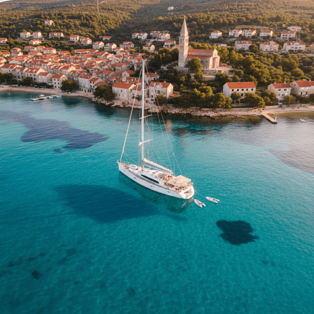
Sailing the Egadi Islands and western Sicily: a week
Sailing the Egadi Islands means short hops across clear water inside Europe's largest marine protected area: Favignana's quarried coves, tiny Levanzo and the steep, cave-riddled cliffs of Marettimo, all within a morning's sail of Trapani. A typical week loops from Trapani through the three islands, then crosses to San Vito lo Capo and the wild Zingaro coast before heading back. Legs are mostly 10 to 22 nautical miles, and nights are spent on reserve buoy fields or in small harbours.
Where to charter a yacht for the Egadi Islands?
The natural base is Trapani, a short sail from Favignana and Levanzo. Marsala works for a southern start near the Stagnone lagoon, while Castellammare del Golfo and Palermo suit a week that begins on the Zingaro side; see all bases on the Sicily page. Charter weeks usually run Saturday to Saturday. To go bareboat you need a licence the charter company accepts (see our guides to the boat licence in Italy and the ICC); otherwise book a skipper or a crewed yacht.
A 7-day sailing itinerary from Trapani
All distances are approximate; plan every leg with up-to-date charts and a pilot book, and check the AMP rules for the current season before you anchor.
Day 1: Trapani to Favignana (approx. 10–12 nm)
Leave Trapani's tourist harbour and head south-west to Favignana, the largest of the three islands. Stop at Cala Rossa on the north-east coast, where old tuff quarries have left tall columns above rock and deep blue water. Overnight in Favignana harbour, where the main town sits around the port, or on one of the AMP buoy fields. Tip: the harbour is open to the north and suffers in a maestrale (north-westerly), so check the forecast before relying on it.
Day 2: Favignana to Marettimo (approx. 12 nm direct, 18–20 nm via the south coast)
Round the east end of Favignana to Cala Azzurra, a fine-sand bay suited to children, and the Bue Marino grottoes near Cala Rossa, then follow the south coast west before crossing zone D to Marettimo. Overnight on one of Marettimo's AMP buoy fields (Scalo Maestro, Cala Manione, Finocchio Marino or Conca), which must be authorised in advance or paid for on site. Tip: the west coast of Marettimo between Punta Mugnone and Punta Libeccio is zone A, closed to charter yachts, so plan your sightseeing along the east side.
Day 3: Marettimo (day on the island)
Marettimo is the highest and rockiest of the Egadi, with one fishing village and a coast full of caves. Walk up to Punta Troia and its Norman castle, or dinghy along the zone C shore on the east side. Stay on the buoy field a second night. Tip: from 1 August to 31 December anchoring is banned at a protected eagle-ray aggregation site off Marettimo, so check the AMP map before you drop the hook anywhere.
Day 4: Marettimo to Levanzo (approx. 13 nm)
Sail back east across open water to Levanzo, the smallest island, with a small port and white houses. Ashore, the Grotta del Genovese holds prehistoric paintings that rank among the most important in the world. Overnight on the buoy fields at Cala Minnola, Cala Fredda or Punta Altarella on the east side. Tip: the whole western side of Levanzo is zone B, and anchoring is banned at Capo Grosso, Cala Tramontana and Cala del Genovese; use the buoys.
Day 5: Levanzo to San Vito lo Capo (approx. 22 nm)
The longest open-water crossing takes you to the mainland and round Capo San Vito. San Vito lo Capo's harbour has several floating pontoons and gives good shelter from south-westerlies and north-westerlies. Overnight in the harbour; book a berth ahead in summer. Tip: the harbour is exposed to scirocco (south-easterly), so if one is forecast, rethink the plan.
Day 6: San Vito lo Capo to Castellammare del Golfo past the Zingaro (approx. 13 nm)
Motor-sail down the east side of the peninsula along the Riserva dello Zingaro, Sicily's first nature reserve, stretching from Cala Mazzo di Sciacca to Tonnarella dell'Uzzo. Enjoy it from the water: within 100 m of the reserve coast motor navigation is always banned, and in the bathing season its coves are closed to boats. Overnight at Castellammare del Golfo's marina, which takes transit yachts. Tip: Castellammare is well sheltered from the west but exposed to north-easterlies and south-easterlies.
Day 7: Castellammare del Golfo to Trapani (approx. 30 nm)
A long final day back round Capo San Vito and south to Trapani, so leave early. Alternatively, sail Day 6 as a there-and-back along the Zingaro from San Vito lo Capo and sleep there again, which cuts the last leg to approx. 18 nm. If you started in Castellammare del Golfo instead, reverse the loop and finish there.
Variation: Marsala and the Stagnone lagoon
From Marsala, the Stagnone lagoon lies just north of the harbour: about 2,000 hectares of very shallow water, in places shallow enough to walk, with the islands of Mozia, Santa Maria, Schola and Isola Grande. It is no place for a keel yacht; view it from outside and explore ashore. Marsala harbour to Favignana is approx. 11 nm, so a Marsala week can simply start and end the Egadi loop here.
| Leg | Distance | Overnight | Highlight |
|---|---|---|---|
| Trapani – Favignana | approx. 10–12 nm | Favignana harbour or AMP buoy field | Cala Rossa quarry columns |
| Favignana – Marettimo | approx. 12–20 nm | Marettimo AMP buoy field | Cala Azzurra, Bue Marino |
| Marettimo | – | Marettimo AMP buoy field | Punta Troia castle, sea caves |
| Marettimo – Levanzo | approx. 13 nm | Cala Minnola / Cala Fredda buoy field | Grotta del Genovese |
| Levanzo – San Vito lo Capo | approx. 22 nm | San Vito lo Capo harbour | Crossing to the mainland |
| San Vito lo Capo – Castellammare del Golfo | approx. 13 nm | Castellammare del Golfo marina | Zingaro coast from the sea |
| Castellammare del Golfo – Trapani | approx. 30 nm | Trapani (base) | Rounding Capo San Vito |
Rules and safety in the Egadi Islands
The Area Marina Protetta Isole Egadi covers almost 54,000 hectares and calls itself the largest marine protected area in Europe. The rules sit in the reserve's regulation and its annual supplementary rules (disciplinare); read the current version on the AMP regulations page.
- Zone A (west coast of Marettimo from Punta Mugnone to Punta Libeccio, and the islet of Maraone): no navigation for charter yachts, no anchoring, no mooring.
- Zone B (Faraglione of Favignana, western Levanzo, parts of Marettimo, the Formica islet): free under sail; within 500 m of the coast motor navigation needs an authorisation, beyond 500 m it is free.
- Zone C (all of Favignana except the Faraglione, eastern Levanzo, eastern Marettimo) and zone D (the waters between the islands): navigation free; anchoring allowed away from protected seabeds, with an authorisation for non-residents.
- Anchoring: the AMP protects Posidonia meadows and coralligenous reefs. In listed sensitive bays such as Cala Rossa, Cala Azzurra, Cala Minnola and Cala Fredda, anchoring is only allowed on sand or mud outside the buoy fields, and yachts of 10–24 m need an authorisation. Keep at least 50 m from other anchored boats. From 15 July to 15 September visitors' anchoring permits exclude those sensitive bays, so plan to use the buoys.
- Buoy fields: one boat per buoy, no anchoring inside the field, no swimming inside the field, and no mooring in bad weather. Authorisations are daily, weekly or monthly, from the AMP office, online or via the app, or at the buoy field (with a surcharge). A fee applies; check the AMP buoy-field page. Ask your charter base whether the yacht already holds AMP authorisations.
- No-go areas: off the Praia beach and the old Florio tuna factory in Favignana, pleasure boats may not navigate, anchor or moor. Jet skis and water-skiing are banned in zones A to C, and no waste or untreated bilge or grey water may be discharged.
- Ferries and hydrofoils: scheduled boats run along the coasts and turn in perpendicular to the shore into the island harbours; Favignana harbour shares its quays between ferries and yachts. Keep clear of their approach lines.
- Zingaro: under a Capitaneria di porto di Trapani ordinance, motor navigation within 100 m of the reserve coast and anchoring within 50 m of it (without authorisation) are banned all year. In the bathing season the coves from Cala Capreria to Tonnarella dell'Uzzo are closed to all but non-motorised beach craft. Local bathing ordinances from the Guardia Costiera in Trapani also apply.
- Winds and harbours: the typical winds are the maestrale (north-west) and the scirocco (south-east). According to the Sicilian regional tourism department's harbour guide, Favignana suffers in a maestrale, San Vito lo Capo and Marsala are exposed to scirocco, and Trapani gets swell with both. Pick your overnight stop by the forecast.
- Licence: according to our guide to the boat licence in Italy, without a licence you may only use engines up to 30 kW (40.8 hp) within 6 nm of the coast; beyond 6 nm or with bigger engines you need a licence. Charter yachts are normally skippered by someone holding a licence the company accepts, or you hire a skipper.
Best time to sail the Egadi Islands
The sailing season runs roughly May to October. The buoy fields are seasonal, and the harbour pontoons in San Vito lo Capo run their full service from June to September. Mid-July to mid-September is the busiest time: the AMP caps boat numbers in the sensitive bays over that period, so book buoys and harbour berths early. Outside that window you have more choice of buoys and berths, but check the forecast carefully for maestrale and scirocco before each crossing.
FAQ
Can I anchor at Cala Rossa on Favignana?
Only under the AMP rules: on sand or mud outside the buoy field, by day, and with an authorisation for yachts over 10 m. From mid-July to mid-September visiting boats should use the Cala Rossa buoy field instead.
Do I need a permit to sail in the Egadi marine reserve?
Sailing through zones B, C and D is free. Mooring on the buoy fields and anchoring by non-residents require an AMP authorisation with a fee, bought per day, week or month. Zone A is closed to charter yachts.
How long is the crossing from Trapani to Marettimo?
About 20 nm in a straight line. Most crews break it with a night on Favignana and sail to Marettimo from there, about 12 nm direct.
Can I sail into the Stagnone lagoon?
Not with a keel yacht. The lagoon is very shallow, in places shallow enough to wade across, so stay outside and visit it from Marsala by land.
Are the Egadi Islands a good area for a first charter?
The legs are short, but crossings are open to the maestrale and scirocco, and anchoring is heavily regulated. A skipper for the first days is a sensible choice if you are new to Mediterranean chartering.
More sailing guides
Heading further along Sicily? Read our guide to sailing the Aeolian Islands, or compare with South Sardinia from Carloforte. Before you go, check our list of what to bring on a yacht charter.



