

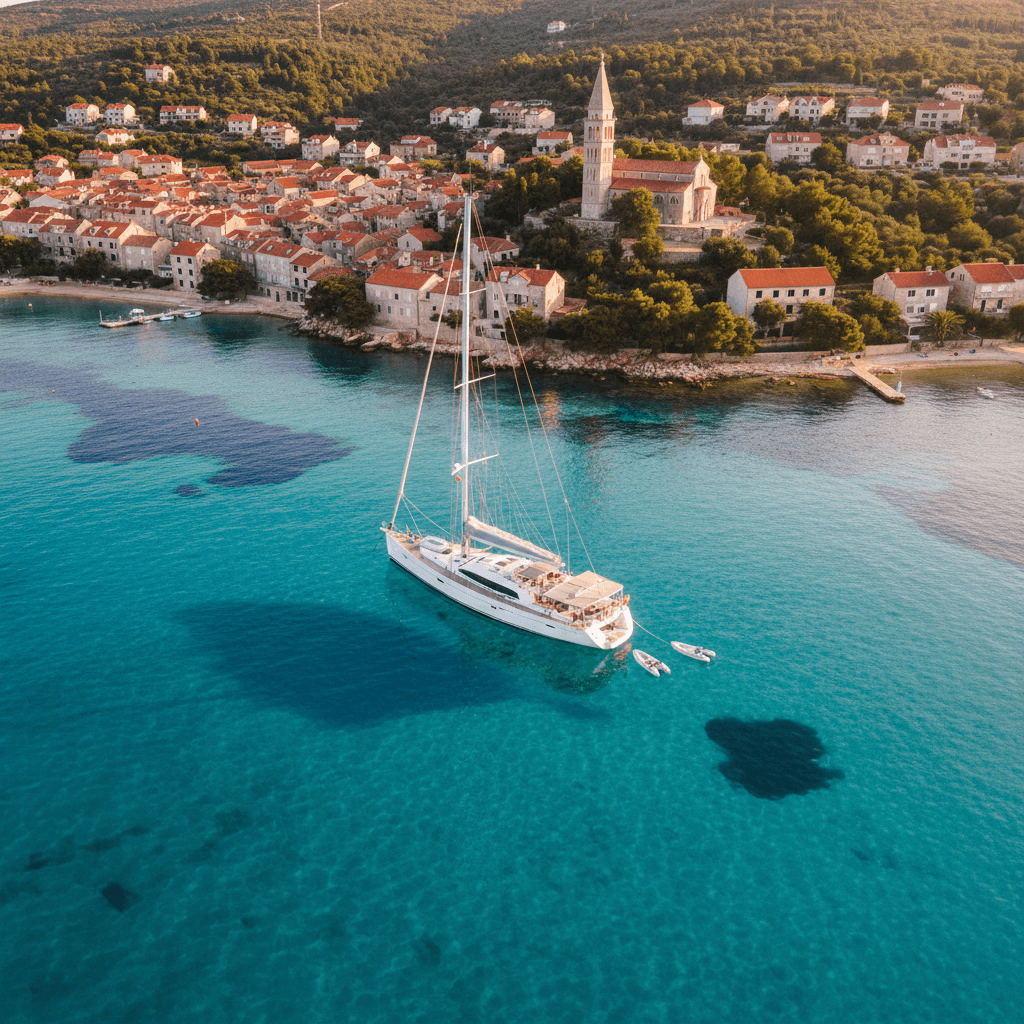
Sailing North Mallorca and Menorca: a week from Pollença
Sailing from Port de Pollença gives you two islands in one week: the cliffs of the Formentor peninsula and the wide bay of Alcúdia on Mallorca, then a crossing of roughly 24 nautical miles to Ciutadella and the white-sand calas of Menorca's south coast. Expect about 120 nm in total, two open-water days, nights in harbours, low-impact buoy fields and sandy anchorages, and a return to Pollença on Friday.
Where to charter a yacht for North Mallorca and Menorca?
The natural base is Port de Pollença at the head of a sheltered bay in the far north of Mallorca; you can also compare yacht charter across Mallorca, or start on the other island with a boat from Mahón (Maó). Whether you pick a monohull or a catamaran, charter weeks usually run Saturday to Saturday. For bareboat you need a licence the charter company accepts, see our guides to the boat licence in Spain and the ICC; without one, hire a skipper or book a crewed yacht.
A 7-day sailing itinerary from Port de Pollença
The distances below are approximate straight-line estimates between harbours and anchorages. Plan every leg with up-to-date charts, a pilot book and the forecast.
Day 1 (Saturday): Port de Pollença to Formentor beach, approx. 3 nm
After check-in, a short hop across Pollença bay takes you to Formentor beach, a long sandy beach backed by pines that reach down to the water, with a small bar and a jetty. The regional port authority Ports IB runs a low-impact buoy field off the beach; you moor to a buoy instead of dropping anchor on the posidonia. Book the buoy online in advance on the Ports IB reservation site. If it is full or you arrive late, stay in Port de Pollença, which has visitor berths (VHF channel 8, also bookable through Ports IB).
Tip: provision in Pollença. There is nothing to buy on the Formentor peninsula beyond the beach bar.
Day 2: Formentor to Cala Figuera and Alcúdia, approx. 16 nm
Motor or sail about 4 nm out to Cap de Formentor, then round it for Cala Figuera, the northernmost beach on Mallorca, between Punta dels Aucells and Punta d'en Tomàs. It is a wild cove with fishermen's boat sheds, posidonia meadows in its shallows and no services at all. Stop for a swim only in settled weather: the cove opens to the north-east. In the afternoon round the cape again and reach across the bay of Alcúdia to Alcúdia, where the Alcudiamar marina (VHF 9) takes yachts up to 30 m.
Tip: at Cala Figuera, drop the anchor only on clear sand patches, never on the dark seagrass.
Day 3: Alcúdia to Cala Ratjada, approx. 18 nm
Cross the bay of Alcúdia towards Cap Ferrutx and follow the north-east coast of Mallorca to Cala Ratjada, a harbour run by Ports IB (VHF 8) at the island's north-east corner and the jumping-off point for Menorca. If there is no berth, Cala Bona, near the long beach of Cala Millor about 7 nm further south, is another Ports IB harbour with a small number of visitor berths.
Tip: Ports IB warns that the berths in Cala Ratjada get uncomfortable in easterly winds. With an easterly forecast, pick Alcúdia or Cala Bona instead and cross another day.
Day 4: Cala Ratjada to Ciutadella, approx. 24 nm
This is the open-water crossing of the Canal de Menorca. The shortest line, from Cap de Capdepera to Cap d'Artrutx on Menorca, is only about 20 nm, so with a steady breeze you arrive in the early afternoon. The port of Ciutadella is run by Ports IB (VHF 8), with some berths managed by the local sailing club; reserve a visitor berth online through Ports IB or contact the port office, and hand in the form the dock master gives you on arrival.
Tip: read AEMET's marine forecast for the "Canal de Menorca" zone the night before and leave early. The channel is exposed to the north, where the tramontana comes from.
Day 5: Ciutadella to Cala en Turqueta and Cala Macarella, approx. 10 nm
Round Cap d'Artrutx and follow the south coast east. Cala en Turqueta lies at the end of a narrow inlet about 400 m deep, with fine white sand and pine-covered cliffs; Cala Macarella and little Macarelleta are a mile further on. Both belong to the Costa Sur de Ciutadella protected area, and both have buoyed swimming zones you must stay outside. Many yachts anchor here in summer. Stay overnight only in settled weather, on sand outside the buoyed zones; otherwise return to Ciutadella.
Tip: arrive before midday. In high summer the best sand patches fill up early, and neither beach has much in the way of services.
Day 6: Menorca's south coast to Cala Ratjada, approx. 26 nm
Cross back from the south coast of Menorca to Cala Ratjada (or to Cala Bona). It is the longest leg of the week, so plan an early start and pick the day with the best forecast.
Tip: if the forecast for Thursday and Friday looks poor, go back a day early. The yacht has to be in Pollença on Friday evening.
Day 7: Cala Ratjada to Port de Pollença, approx. 23 nm
Sail back along the north-east coast and across the bay of Alcúdia, round Cap des Pinar and enter Pollença bay. Fill up with fuel and be on the berth in time for the check-out.
Itinerary at a glance
| Leg | Distance | Overnight | Highlight |
|---|---|---|---|
| Port de Pollença to Formentor beach | approx. 3 nm | Ports IB buoy field (book) or Port de Pollença | Pine-fringed Formentor beach |
| Formentor to Cala Figuera to Alcúdia | approx. 16 nm | Alcudiamar marina | Cap de Formentor and Mallorca's northernmost beach |
| Alcúdia to Cala Ratjada | approx. 18 nm | Port de Cala Ratjada (Ports IB) | Bay of Alcúdia, north-east coast |
| Cala Ratjada to Ciutadella | approx. 24 nm | Port de Ciutadella (Ports IB) | Crossing the Canal de Menorca |
| Ciutadella to Turqueta and Macarella | approx. 10 nm | At anchor on sand (settled weather) or Ciutadella | White-sand calas of the south coast |
| Menorca to Cala Ratjada | approx. 26 nm | Port de Cala Ratjada or Cala Bona | Open-water return crossing |
| Cala Ratjada to Port de Pollença | approx. 23 nm | Port de Pollença | Back across the bay of Alcúdia |
With more time: Fornells and Maó
Menorca's north and east do not fit into a one-week loop from Pollença, but they are the heart of a week from Maó, or of a second week. Fornells, about 19 nm from Ciutadella along the rocky north coast, is a large, shallow bay with a Ports IB harbour (VHF 8) and a Ports IB buoy field. Further east, Ports IB has another buoy field at Illa d'en Colom and Cala Tamarells. Maó has a natural harbour more than 5 km long, with the islets of Llatzaret and Illa del Rei inside it and the La Mola fortress guarding the entrance. Its berths are run by marinas and clubs under concession from the Balearic Port Authority, so book directly with them.
Rules and safety in North Mallorca and Menorca
- Posidonia: under Balearic Decree 25/2018, anchoring on Posidonia oceanica seagrass is prohibited as a general rule. Anchor on sand, or use authorised low-impact buoys. The official seagrass map is the Balearic government's posidonia viewer. Our guide to anchoring and posidonia in the Balearics explains the rules in detail.
- Buoy fields: Ports IB runs eight ecological buoy fields, including Formentor on Mallorca and Badia de Fornells and Illa d'en Colom–Cala Tamarells on Menorca. The season runs from 1 June to 30 September and may be extended to mid-October; book through the Ports IB reservation platform, with categories up to 25 m. Inside a regulated buoy field you must moor to a buoy and may not drop your anchor.
- Reserva Marina del Nord de Menorca: this marine reserve on Menorca's north (tramuntana) coast lies between Punta Morter, Illa dels Porros and Cap Gros and includes part of Fornells bay. Recreational fishing is only allowed on set days with restricted gear, and spearfishing is prohibited; check the rules with the Balearic marine reserves service before fishing or diving.
- Menorca Biosphere Reserve: UNESCO recognised Menorca as a biosphere reserve in 1993. In 2019 the reserve was extended to the sea around the island out to 12 nautical miles, so every Menorca anchorage lies inside it (Consell Insular de Menorca).
- Swimming zones: popular beaches such as Macarella and Turqueta have buoyed swimming areas. Stay outside them and approach slowly.
- Tramontana: AEMET describes the tramontana as a dry, cold, violent and persistent north wind that funnels through the Gulf of Lion to the Balearics, hitting the northernmost islands hardest. It is much more common in winter and around the equinoxes than in summer (AEMET). Use the AEMET Balearic marine forecast, which has a separate "Canal de Menorca" zone.
- Rissaga: Ciutadella's harbour is known for rissagas, sudden rises and falls of sea level caused by the atmosphere. Check the AEMET warnings and leave extra slack in your mooring lines.
- Emergencies: Salvamento Marítimo answers on VHF channel 16 and on 900 202 202 or 112.
- Licence: from 1 October 2026 anyone driving a rented boat in Spain needs a licence, because the old licence-free rental of small boats has ended. A bareboat yacht needs a licence that covers its size and sailing area and that Spain recognises; the ICC is the safe choice. With a skipper or crew you need none. See boat licence in Spain.
Best time to sail North Mallorca and Menorca
The Balearic sailing season runs roughly from May to October. The Ports IB buoy fields are staffed from 1 June to 30 September, which is a good guide to when the anchorages are busiest. High summer is the peak: book buoys and visitor berths in Ciutadella and Cala Ratjada in advance. The tramontana is infrequent in summer and more common in spring, autumn and winter, so crossings in May, early June and October need more flexibility. In any month, take the AEMET forecast as the deciding factor for the crossing days.
FAQ
How far is it from Mallorca to Menorca by sailing yacht?
From Cala Ratjada to Ciutadella it is approx. 24 nm, and the shortest line between the two islands, from Cap de Capdepera to Cap d'Artrutx, is about 20 nm. At 5 to 6 knots that is four to five hours.
Can I anchor anywhere in Menorca's calas?
No. Anchoring on posidonia is prohibited, buoyed swimming zones are off limits, and in regulated buoy fields you must use a buoy. Drop the anchor on clear sand and check the official posidonia map.
Do I need to book the buoys at Formentor and Fornells?
Yes. Book online through Ports IB for the season from 1 June to 30 September. The buoys are allocated by boat length.
Is one week enough to see all of Menorca?
Not from Pollença. A week covers North Mallorca, Ciutadella and the south-west calas. For Fornells, Illa d'en Colom and Maó's harbour, charter from Maó or plan a second week.
What if the tramontana blows?
Do not start the crossing. Wait in a sheltered harbour such as Pollença or Alcúdia on the Mallorca side, and give yourself a buffer day before the Friday return.
More sailing guides for the Balearics
Planning the south of Mallorca instead? Read our Mallorca sailing week from Palma and Cabrera, or head for the Pitiusas with the Ibiza and Formentera sailing week.



