

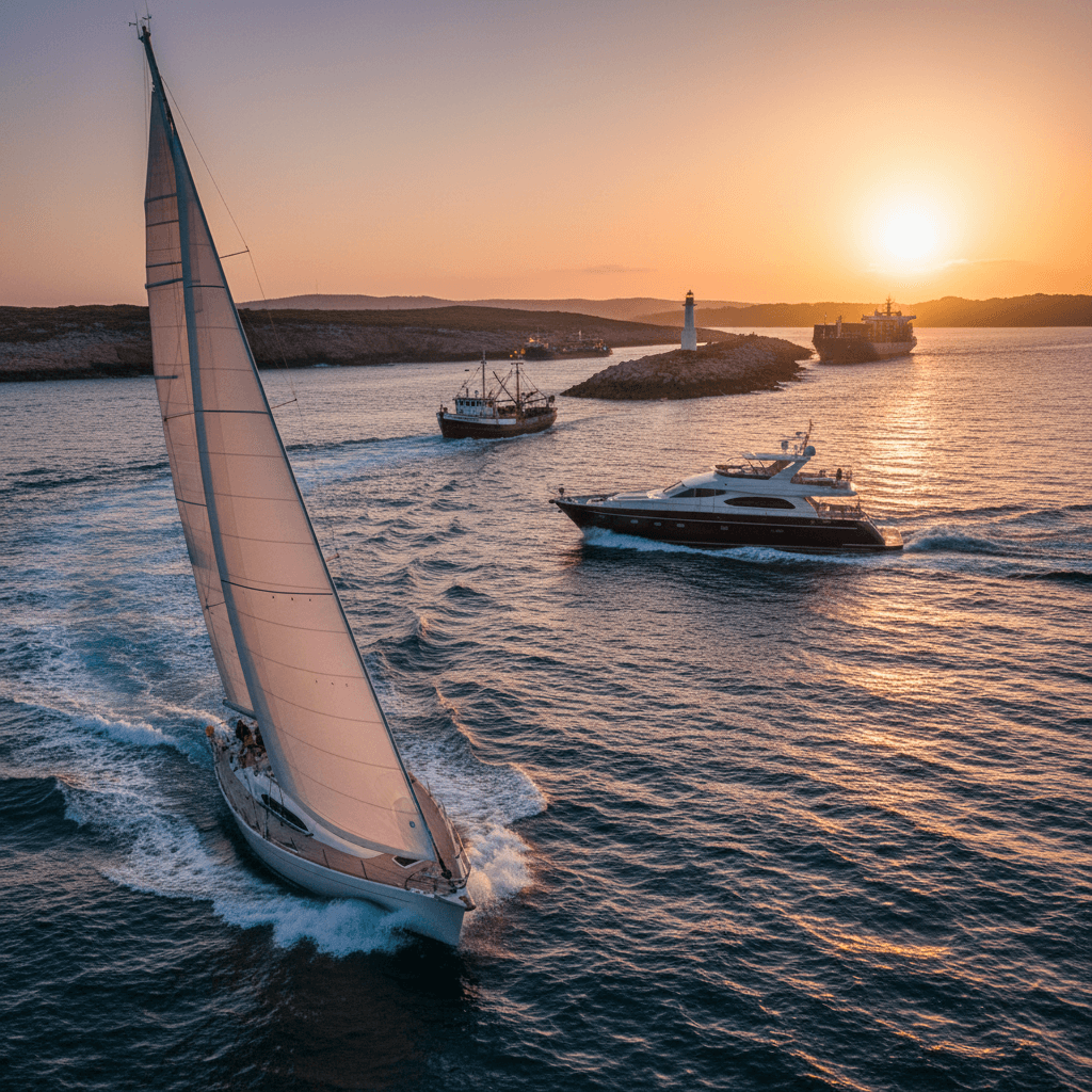
Porquerolles by Boat: Sailing the Hyères Islands
The Hyères islands are a short sailing ground of clear water and protected shores. Porquerolles and Port-Cros both lie inside Port-Cros National Park, and Le Levant is mostly a military test site. The rules are strict but the legs are short: a week from Bormes-les-Mimosas or Saint-Mandrier means 7–12 nm a day, a park buoy at Port-Cros, an anchorage off the Porquerolles beaches, a night in Porquerolles harbour and a day sail across the Hyères roads.
Where to charter a yacht for the Hyères islands?
The closest base is Bormes-les-Mimosas, a large marina facing the islands, a short walk from Le Lavandou: see yacht charter in Bormes-les-Mimosas. From the Toulon side, Saint-Mandrier-sur-Mer adds a longer first leg past the Giens peninsula. Compare other bases on the French Riviera and France pages. Charter weeks usually run Saturday to Saturday. For bareboat, you need a licence and sailing experience that the charter company accepts (see boat licence in France and the ICC). Otherwise hire a skipper or a crewed yacht. Charter yachts from these bases can be booked on Ship O'Hoi, bareboat or with a skipper.
A 7-day sailing itinerary from Bormes-les-Mimosas
Distances are rough chart estimates; plan with current charts, a pilot book and the park's regulation maps (the Nav&co app shows the zones). One rule shapes the week: boats over 12 m may not anchor in two cable zones, one between Cap Bénat, Port-Cros and Le Levant (including Port-Man bay), the other between the Giens peninsula and north-west Porquerolles. Check your yacht's length before choosing an anchorage.
Day 1: Bormes-les-Mimosas to Port-Cros via Le Levant (approx. 11 nm)
Round Cap Bénat and steer for the north-west side of Le Levant. About 80 % of the island is a military test centre; only the north-west, with Héliopolis village and the small harbour of l'Ayguade, is civilian. Don't anchor (it is banned in the zones north and south of the island) and keep well outside the 200 m strip around the eastern part, which is closed to all boats. Cross the passe des Grottes to Port-Cros and take a harbour buoy (free 9:00–18:00, overnight fee paid at the office) or a buoy in the ZMEL de Bagaud.
Tip: harbour buoys take boats up to 15 m; bigger yachts use the stone quay by reservation. Call on VHF 9. No fuel, electricity or showers.
Day 2: Port-Cros, the underwater trail and the Bagaud buoy field (approx. 1 nm)
Take the dinghy to the plage de la Palud pontoon (dinghies under 5 m) and snorkel the underwater trail; yachts may not enter the trail zone. Walk the marked trails (off-trail walking is banned from 15 June to 15 September). In the evening move to the ZMEL de Bagaud in the pass between Port-Cros and Bagaud: 68 buoys (60 for boats up to 15 m), open 15 April to 15 October, free by day, booked and paid for the night on portcros.smartwaters.com.
Tip: no anchoring in the ZMEL; one person must stay aboard; five nights maximum.
Day 3: Port-Cros to Porquerolles, Notre-Dame anchorage (approx. 7 nm)
Sail west to the north coast of Porquerolles. Plage Notre-Dame is the classic anchorage. An 830 m by 150 m zone off the beach is closed to motor craft, so anchor outside the buoyed line, on sand rather than posidonia. From 15 June to 15 September the north-coast strip between Pointe du Bon Renaud and Pointe du Lequin is a "clean anchoring zone" for boats under 24 m with a holding tank.
Tip: the cable zone closed to boats over 12 m starts at Pointe de Béarlieu, just east of the harbour, and runs west; check its chart.
Day 4: Notre-Dame to Porquerolles harbour via La Courtade (approx. 2.5 nm)
Pass plage de la Courtade (another zone closed to motor craft) into Porquerolles harbour: 293 visitor berths, water, electricity, fuel, VHF 9. Explore the island on foot.
Tip: contact the harbour office directly about a berth, ahead of time in summer. From 21 June to 21 September parts of the island can close when fire risk is high.
Day 5: Plage d'Argent and a Hyères roads day sail (approx. 10 nm)
Motor 1.5 nm west to plage d'Argent for a swim (a zone off the east end is closed to motor craft, and only boats up to 12 m may anchor here, inside the cable zone). Then sail the Hyères roads towards the Giens peninsula and return to Porquerolles for the night.
Tip: from 15 June to 30 September landing is banned between Cap Rousset and plage Blanche and on the Grand Langoustier peninsula.
Day 6: Porquerolles to Bormes-les-Mimosas (approx. 12 nm)
Cross back east, round Cap Bénat, keep clear of the closed zone off the Fort de Brégançon and return to Bormes to refuel and check in on Friday evening.
Tip: the mistral blows from the west here, so it is usually behind you on this leg.
Starting from Saint-Mandrier instead (approx. 17 nm to Porquerolles)
Saint-Mandrier lies in the Petite Rade of Toulon (340 visitor berths, boats up to 20 m). In the Toulon roads keep watch on VHF 74, stay 100 m from warships, 500 m from an aircraft carrier and 300 m from a submarine, and keep out of the zones closed to civilian boats, including around the Saint-Mandrier peninsula to Cap Cépet. Anchoring is banned in the Petite Rade. Sail out through the Grande Rade and east past Giens to Porquerolles, then run the loop in reverse. Cap Sicié, west of the peninsula, is the way towards the Calanques.
| Leg | Distance | Overnight | Highlight |
|---|---|---|---|
| Bormes – Port-Cros via Le Levant | approx. 11 nm | Port-Cros harbour or ZMEL Bagaud | Military island from the water |
| Port-Cros day | approx. 1 nm | ZMEL Bagaud (booked) | Underwater trail at La Palud |
| Port-Cros – Notre-Dame | approx. 7 nm | Anchorage, Porquerolles north coast | Sandy bay, clear water |
| Notre-Dame – Porquerolles | approx. 2.5 nm | Porquerolles harbour | Village and island walks |
| Plage d'Argent and Hyères roads | approx. 10 nm | Porquerolles harbour or anchorage | Swim stop, Giens peninsula |
| Porquerolles – Bormes | approx. 12 nm | Bormes-les-Mimosas marina | Cap Bénat, Le Lavandou |
Rules and safety in the Hyères islands
- National park. The marine heart reaches 600 m from the shore of Porquerolles and Port-Cros. Jet skis, towed devices and underwater scooters are banned there, drones are banned in the park, and no waste water may be discharged. Scuba diving needs a park authorisation; snorkelling does not. The current rules and maps are on the park's navigation page.
- Port-Cros. Only boats with holding tanks may anchor or moor. Speed: 12 knots at 300–600 m, 5 knots within 300 m and in the ZMEL, 3 knots in the harbour. No anchoring in Port-Cros bay outside the harbour and ZMEL or along the north coast between Pointe du Grand-Père and Pointe de la Galère; parts of Port-Man bay are closed to boats. Fishing is banned except trolling, spearfishing is prohibited, dogs are regulated and landing on the islets is forbidden.
- Porquerolles. 5 knots within 300 m, 3 knots in the harbour, no anchoring within 100 m of dive buoys; beach zones and the summer clean anchoring zone as described above. Boats over 24 m may not anchor in the Hyères roads.
- Le Levant. Préfecture maritime order 55/2021 closes a 200 m strip around the military part to all boats, swimmers and divers, closes zones offshore to the south-east from 1 September to 30 June, and bans anchoring north and south of the island. Missile-test closures come as separate orders: check the Préfecture maritime orders before you sail.
- Anchoring time. You may anchor in one spot for 72 hours; then boats under 24 m without AIS must move at least 500 m. Always anchor on sand, not posidonia.
- Winds. According to Météo-France, the mistral blows from the west on the Var coast, around 50 km/h with gusts of 80–100 km/h, often strongest in winter and spring and sometimes for several days. Port-Cros harbour is exposed to it (dangerous above force 6, closed above force 7). The levant (east wind) brings cloud and rain, mostly from late autumn to spring; the marin blows from the south-east.
- Emergencies. At sea, call the CROSS on VHF channel 16. From the coast, dial 196 (mer.gouv.fr).
- Licence. A sailing boat needs no licence at sea in France, whatever its size; a motorboat over 4.5 kW (6 hp) needs the permis plaisance or a valid licence from your own country, within its limits. For bareboat charter the company still asks for proof of experience (a sailing CV, often a licence or ICC) and can require a skipper. With a skipper you need none. See boat licence in France.
Best time to sail the Hyères islands
The season runs from May to October: the Bagaud buoy field is open 15 April to 15 October and the Port-Cros harbour office 1 April to 31 October. July, August and the May bank-holiday weekends are the busiest, and most summer-only rules apply from mid-June to mid-September. June and September are outside the peak, though the mistral can blow at any time. Strong "largade" storms are mainly an autumn and winter feature, say the local ports.
FAQ
Can you sail from St Tropez to Porquerolles by boat?
Yes, a long day of approx. 30 nm west along the Maures coast past Cap Bénat. Many crews break it at Bormes-les-Mimosas or Port-Cros.
Do I need to book a buoy at Port-Cros?
Only for the night: ZMEL de Bagaud buoys are free 8:00–18:00, and night stays are booked and paid online. In the harbour you pay the overnight fee on arrival.
Can I anchor anywhere off Porquerolles?
No. The beach zones are closed to motor craft, several zones ban anchoring, boats over 12 m may not anchor in the north-west cable zone, and in summer the north coast is reserved for boats with holding tanks.
Can I land on Le Levant?
Only the civilian north-west corner. The small harbour of l'Ayguade takes leisure boats, mainly in summer, but has only a handful of mooring spots; the rest of the island is military.
What happens if the mistral blows?
Stay in a sheltered harbour and check the Météo-France marine forecast every morning; Port-Cros harbour closes above force 7.
More sailing guides
Head east with our Saint-Tropez to Cannes sailing guide, or west to Marseille, the Calanques and Frioul. Before you go, read what to bring on a yacht charter.



